|
|
Fort Bragg NC (AFNS) Nov 04, 2009 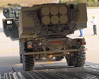 Soldiers with 3rd Battalion, 27th Field Artillery, drove their High Mobility Artillery Rocket System (HIMARS) out the rear of an Air Force C-17 Globemaster III at Pope Air Force Base, N.C., Oct. 22, with a new advancement that will get them into the fight faster. The 'Hot Panel' program allows the HIMARS to link into an aircraft's GPS and track itself in the air, anywhere in the world. The ... read more
 Washington DC (SPX) Nov 04, 2009
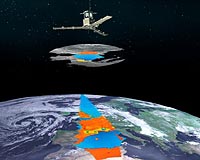
Launched from Vandenberg Air Force Base, Calif., aboard an United Launch Alliance Atlas V launch vehicle, Oct. 18, 2009, the Special Sensor Ultraviolet Limb Imager (SSULI) developed by NRL's Space Science Division and Spacecraft Engineering Department offers a first of its kind technique for remote sensing of the ionosphere and thermosphere from space. Flying on-orbit the U.S. Air Force ... more
|
| |||||||||||||||
| Previous Issues | Nov 04 | Nov 03 | Nov 02 | Oct 30 | Oct 29 |
| . |
 Merrimack NH (SPX) Nov 04, 2009
Raymarine has introduced the 33STV, the latest in their line of Satellite TV Antenna Systems, which features a high performance 13" satellite dish inside a compact 14" radome, weighing less than ten pounds, to accommodate both powerboats and sailboats under 25 feet in length. Equipped with Dynamic Beam Tilting and Wide Range Search, all of Raymarine's Satellite TV Systems are able to track ... more  Peterson AFB CO (SPX) Nov 04, 2009
Could a U.S. Space and Rocket Center, Space Camp grad be the next U.S Air Force F-16 Pilot or GPS System operator? The Air Force only hopes so. The U.S. Space and Rocket Center is located in Huntsville, Alabama. "Space Camp" is what the center is commonly known as and provides residental and day camp educational programs for children in various age groups and adults. Space Camp is a series ... more  Newtown PA (SPX) Nov 03, 2009
The third Global Positioning System Block IIR (GPS IIR-3) satellite, designed and built by Lockheed Martin to provide significantly improved navigation capabilities for military and civilian users worldwide, has reached 10 years of successful on-orbit operational service. The satellite was launched on Oct. 7, 1999, and is one of 30 GPS spacecraft currently on-orbit, providing critical ... more |
. |
|
|
. |
 Vancouver, Canada (AFP) Oct 31, 2009
The Salish Sea may never appear on official navigation maps, but residents of western regions in the United States and Canada hope a new name will protect their shared coastal waters. A Washington State agency approved the new name Friday for the body of water off North America's west coast that includes Puget Sound, the Strait of Juan de Fuca, and Georgia Strait. The name is partly in ... more  London, UK (SPX) Oct 30, 2009
GeoLife and PosiMotion have announced that they have submitted an application to the Apple App Store which enables personal turn-by-turn navigation on both the iPod touch and the iPhone. When the application is approved it will be the first navigation solution available for the iPod touch. Navigation on the iPod touch is made possible through Geolife's Navmii software and PosiMotion's ... more  Greenbelt MD (SPX) Oct 30, 2009
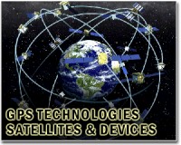
Many of us have been rescued from unfamiliar territory by directions from a Global Positioning System (GPS) navigator. GPS satellites send signals to a receiver in your GPS navigator, which calculates your position based on the location of the satellites and your distance from them. The distance is determined by how long it took the signals from various satellites to reach your receiver. ... more |
. |
| Previous Issues | Nov 04 | Nov 03 | Nov 02 | Oct 30 | Oct 29 |
| The contents herein, unless otherwise known to be public domain, are Copyright 1995-2009 - SpaceDaily. AFP and UPI Wire Stories are copyright Agence France-Presse and United Press International. ESA Portal Reports are copyright European Space Agency. All NASA sourced material is public domain. Additional copyrights may apply in whole or part to other bona fide parties. Advertising does not imply endorsement, agreement or approval of any opinions, statements or information provided by SpaceDaily on any web page published or hosted by SpaceDaily. Privacy statement |