|
|
Schriever AFB CO (AFNS) Nov 02, 2009  Canberra, Australia (UPI) Oct 30, 2009
 Australia's Defense Department has approved a $455 million artillery replacement project to include four batteries of 35 M777A2 155mm lightweight towed Howitzer field guns. Defense Minister Sen. John Faulkner said in a written statement that purchase of the Howitzers, made by the Land Systems division of BAE Systems in the United States, is the first phase of project Land 17 to provide ... more
|
| |||||||||||||||
| Previous Issues | Oct 30 | Oct 29 | Oct 28 | Oct 27 | Oct 26 |
| . |
 Vancouver, Canada (AFP) Oct 31, 2009
The Salish Sea may never appear on official navigation maps, but residents of western regions in the United States and Canada hope a new name will protect their shared coastal waters. A Washington State agency approved the new name Friday for the body of water off North America's west coast that includes Puget Sound, the Strait of Juan de Fuca, and Georgia Strait. The name is partly in ... more  London, UK (SPX) Oct 30, 2009
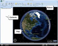
GeoLife and PosiMotion have announced that they have submitted an application to the Apple App Store which enables personal turn-by-turn navigation on both the iPod touch and the iPhone. When the application is approved it will be the first navigation solution available for the iPod touch. Navigation on the iPod touch is made possible through Geolife's Navmii software and PosiMotion's ... more  Greenbelt MD (SPX) Oct 30, 2009
Many of us have been rescued from unfamiliar territory by directions from a Global Positioning System (GPS) navigator. GPS satellites send signals to a receiver in your GPS navigator, which calculates your position based on the location of the satellites and your distance from them. The distance is determined by how long it took the signals from various satellites to reach your receiver. ... more |
. |
|
|
. |
 Boulder CO (SPX) Oct 28, 2009
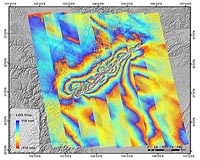
The first images taken by the WorldView-2 remote-sensing satellite designed and built by Ball Aerospace and Technologies for DigitalGlobe were released on October 20 - just 11 days after the satellite's successful launch from Vandenberg Air Force Base, Calif. DigitalGlobe released images of Love Field Airport near Dallas and the AT and T Center in San Antonio, Texas. More refinements to ... more 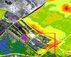 Tel Aviv, Israel (SPX) Oct 27, 2009
One small step for mankind is now a leap for averting natural and man-made disasters on earth. New Tel Aviv University technology combines sophisticated sensors in orbit with sensors on the ground and in the air to create a "Hyperspectral Remote Sensor" (HRS). It can give advance warnings about water contamination after a forest fire, alert authorities of a pollution spill long before a ... more  Buckingham, UK (SPX) Oct 26, 2009
Since its release in March, the new LabSat has already made a mark on the GPS Simulator market, with uptake from a number of large GPS product manufacturers looking for realistic and repeatable testing. Development has continued at the same pace, and Racelogic have now announced a new capability for LabSat in the form of video synchronisation. Using a Racelogic Video VBOX, a GPS data ... more |
. |
| Previous Issues | Oct 30 | Oct 29 | Oct 28 | Oct 27 | Oct 26 |
| The contents herein, unless otherwise known to be public domain, are Copyright 1995-2009 - SpaceDaily. AFP and UPI Wire Stories are copyright Agence France-Presse and United Press International. ESA Portal Reports are copyright European Space Agency. All NASA sourced material is public domain. Additional copyrights may apply in whole or part to other bona fide parties. Advertising does not imply endorsement, agreement or approval of any opinions, statements or information provided by SpaceDaily on any web page published or hosted by SpaceDaily. Privacy statement |