|
|
Greenbelt MD (SPX) Oct 28, 2009  Three of the satellite instruments that will fly on an upcoming satellite mission called "FASTSAT" have been created at one NASA center and have arrived at another for more tests to ensure they are flight ready for launch. They're now at the Marshall Space Flight Center in Huntsville, Ala. for further testing. "FASTSAT" means "Fast, Affordable, Science and Technology Satellite." The ... read more
 Boulder CO (SPX) Oct 28, 2009
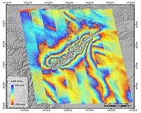
The first images taken by the WorldView-2 remote-sensing satellite designed and built by Ball Aerospace and Technologies for DigitalGlobe were released on October 20 - just 11 days after the satellite's successful launch from Vandenberg Air Force Base, Calif. DigitalGlobe released images of Love Field Airport near Dallas and the AT and T Center in San Antonio, Texas. More refinements to ... more
|
| |||||||||||||||
| Previous Issues | Oct 27 | Oct 26 | Oct 23 | Oct 22 | Oct 21 |
| . |
 Tel Aviv, Israel (SPX) Oct 27, 2009
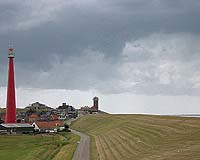
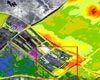
One small step for mankind is now a leap for averting natural and man-made disasters on earth. New Tel Aviv University technology combines sophisticated sensors in orbit with sensors on the ground and in the air to create a "Hyperspectral Remote Sensor" (HRS). It can give advance warnings about water contamination after a forest fire, alert authorities of a pollution spill long before a ... more  Buckingham, UK (SPX) Oct 26, 2009
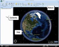
Since its release in March, the new LabSat has already made a mark on the GPS Simulator market, with uptake from a number of large GPS product manufacturers looking for realistic and repeatable testing. Development has continued at the same pace, and Racelogic have now announced a new capability for LabSat in the form of video synchronisation. Using a Racelogic Video VBOX, a GPS data ... more  Rio De Janeiro (AFP) Oct 17, 2009
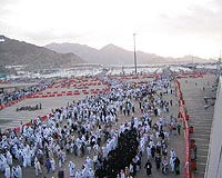
Rio's favelas are home to a third of the city's population, but are almost invisible on maps -- a situation five young women are trying to change with the help of GPS and the Internet. Rafaela Goncalves da Silva, 21, has lived in the Santa Marta favela, a poor and dangerous slum that was recently the target of a police pacification operation, since she was two years old. She is bringing ... more |
. |
|
|
. |
 Moscow, Russia (RIA Novosti) Oct 14, 2009
Russia is planning to orbit three Glonass navigation satellites on October 29 following their launch cancellation in September, the Federal Space Agency Roscosmos said on Monday. The planned September 25 launch of Glonass satellites from the Bikonur space center in Kazakhstan has been moved back by over a month due to a technical defect in one of the satellites. "This launch is in ... more  Dearborn MI (SPX) Oct 13, 2009
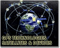
Researchers have found potential for a GPS satellite to act as an early warning system that detects when a vehicle is about to lose control and communicate with the vehicle's stability control systems and other safety features to prevent a rollover or other serious accident. The research findings will be presented next week at the Institute of Electrical and Electronics ... more  Redlands CA (SPX) Oct 13, 2009
The Virginia Department of Emergency Management (VDEM) recently launched the Virginia Interoperability Picture for Emergency Response (VIPER) using enterprise geographic information system (GIS) software from ESRI. In addition to providing a Web-based common operating picture and analysis tools, VIPER integrates with numerous information systems and links with approximately 250 data feeds. ... more |
. |
| Previous Issues | Oct 27 | Oct 26 | Oct 23 | Oct 22 | Oct 21 |
| The contents herein, unless otherwise known to be public domain, are Copyright 1995-2009 - SpaceDaily. AFP and UPI Wire Stories are copyright Agence France-Presse and United Press International. ESA Portal Reports are copyright European Space Agency. All NASA sourced material is public domain. Additional copyrights may apply in whole or part to other bona fide parties. Advertising does not imply endorsement, agreement or approval of any opinions, statements or information provided by SpaceDaily on any web page published or hosted by SpaceDaily. Privacy statement |