|
|
London, UK (SPX) Oct 30, 2009 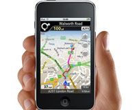 GeoLife and PosiMotion have announced that they have submitted an application to the Apple App Store which enables personal turn-by-turn navigation on both the iPod touch and the iPhone. When the application is approved it will be the first navigation solution available for the iPod touch. Navigation on the iPod touch is made possible through Geolife's Navmii software and PosiMotion's ... read more
 Greenbelt MD (SPX) Oct 30, 2009
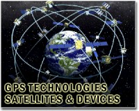
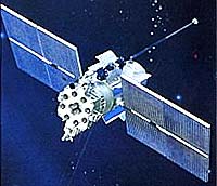
Many of us have been rescued from unfamiliar territory by directions from a Global Positioning System (GPS) navigator. GPS satellites send signals to a receiver in your GPS navigator, which calculates your position based on the location of the satellites and your distance from them. The distance is determined by how long it took the signals from various satellites to reach your receiver. ... more
|
| |||||||||||||||
| Previous Issues | Oct 29 | Oct 28 | Oct 27 | Oct 26 | Oct 23 |
| . |
 Morgantown WV (SPX) Oct 30, 2009
The U.S. Naval Air Systems Command (NAVAIR) recently demonstrated autonomous operations by multiple "swarms" of unmanned air and ground vehicles, unattended ground sensors, video cameras and other devices linked together in an intelligent network powered by EdgeFrontier platform technologies from Augusta Systems, Inc. The demonstrations were held at a National Aeronautics and Space ... more  Washington (AFP) Oct 29, 2009
Motorola is counting on Google juice to power its mobile phones and its future. "The vast majority of our devices will be launched on the Android platform," Motorola co-chief executive Sanjay Jha said on Thursday after the biggest US handset maker surprised Wall Street by reporting a small quarterly net profit. "We are very open to other options here, and we are engaged in exploring ... more  Redlands CA (SPX) Oct 29, 2009
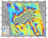
Forestry Development Centre Tapio of Finland is using ESRI's ArcGIS software and a solution designed by Tieto, an ESRI business partner, to meet Forestry Centres' goal to decrease forest inventory costs by 40 percent. The solution is designed to improve productivity, cost efficiency, and cooperation between organizations, including data procurement and two-way dataflow. It will also ... more |
. |
|
|
. |
 Rio De Janeiro (AFP) Oct 17, 2009
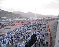
Rio's favelas are home to a third of the city's population, but are almost invisible on maps -- a situation five young women are trying to change with the help of GPS and the Internet. Rafaela Goncalves da Silva, 21, has lived in the Santa Marta favela, a poor and dangerous slum that was recently the target of a police pacification operation, since she was two years old. She is bringing ... more  Redlands CA (SPX) Oct 19, 2009
Secretary of the Interior Ken Salazar recently signed an order to establish a coordinated strategy within the United States Department of the Interior (DOI) to improve response to climate change. During the press conference announcing the order, DOI staff used ESRI geographic information system (GIS) technology to demonstrate the current and future impacts of global climate change. ... more  Jerusalem (AFP) Oct 18, 2009
Navigating the contours of the Israeli-Palestinian conflict can be confusing -- even for satellite navigation systems. But soon, if the Israeli army has its way, the Global Positioning System (GPS) will get a lesson in the political complexities of the disputed region. The military has approached the company that makes the maps for the personal navigation devices, asking them to ... more |
. |
| Previous Issues | Oct 29 | Oct 28 | Oct 27 | Oct 26 | Oct 23 |
| The contents herein, unless otherwise known to be public domain, are Copyright 1995-2009 - SpaceDaily. AFP and UPI Wire Stories are copyright Agence France-Presse and United Press International. ESA Portal Reports are copyright European Space Agency. All NASA sourced material is public domain. Additional copyrights may apply in whole or part to other bona fide parties. Advertising does not imply endorsement, agreement or approval of any opinions, statements or information provided by SpaceDaily on any web page published or hosted by SpaceDaily. Privacy statement |