|
|
Newtown PA (SPX) Nov 03, 2009 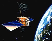 The third Global Positioning System Block IIR (GPS IIR-3) satellite, designed and built by Lockheed Martin to provide significantly improved navigation capabilities for military and civilian users worldwide, has reached 10 years of successful on-orbit operational service. The satellite was launched on Oct. 7, 1999, and is one of 30 GPS spacecraft currently on-orbit, providing critical ... read more
 Plesetsk, Russia (ESA) Nov 02, 2009
The second satellite in ESA's Earth Explorer series-the Soil Moisture and Ocean Salinity (SMOS) mission-and the second demonstration satellite under ESA's Project for Onboard Autonomy (Proba-2) were launched into orbit last night from northern Russia. SMOS will play a key role in the monitoring of climate change on a global scale. It is the first ever satellite designed both to map sea sur ... more
|
| |||||||||||||||
| Previous Issues | Nov 02 | Oct 30 | Oct 29 | Oct 28 | Oct 27 |
| . |
 Naval Air Warfare Center CA (SPX) Nov 03, 2009
Raytheon and the U.S. Navy completed the first free-flight demonstration of the Joint Standoff Weapon Extended Range air-to-surface precision guided missile. The JSOW-ER is a powered variant of the combat-proven glide JSOW. It takes the GPS-inertial navigation system reliability of existing JSOW variants and combines it with the network-enabled maritime-interdiction capabilities currently ... more  Paris (AFP) Nov 2, 2009
The European Space Agency on Monday launched a water tracking satellite that will help give faster predictions of floods and other extreme weather incidents caused by global warming. The 315 million euro (460 million dollar) Soil Moisture and Ocean Salinity probe was carried into space on a Russian Rockot launcher from the Plesetsk cosmodrome in northern Russia. The ESA said it is ... more  Stanford, California (AFP) Nov 2, 2009
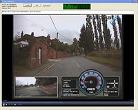
Imagine driving at top speed on a steep, winding mountain pass in the Alps, or the Himalayas, or the Rocky Mountains. Now, take your hands off the steering wheel and cover your eyes. Or grab a camera and take some pictures of the snowy mountain peaks. Or send a text message to a friend describing the scenery. You'd skid off the road and plunge into a deep ravine within seconds, right? ... more |
. |
|
|
. |
 Washington (AFP) Oct 29, 2009
Motorola is counting on Google juice to power its mobile phones and its future. "The vast majority of our devices will be launched on the Android platform," Motorola co-chief executive Sanjay Jha said on Thursday after the biggest US handset maker surprised Wall Street by reporting a small quarterly net profit. "We are very open to other options here, and we are engaged in exploring ... more  Redlands CA (SPX) Oct 29, 2009
Forestry Development Centre Tapio of Finland is using ESRI's ArcGIS software and a solution designed by Tieto, an ESRI business partner, to meet Forestry Centres' goal to decrease forest inventory costs by 40 percent. The solution is designed to improve productivity, cost efficiency, and cooperation between organizations, including data procurement and two-way dataflow. It will also ... more  Paris, France (ESA) Oct 29, 2009
The Galileo Master prize for 2009 has been awarded to Jose Caro Ramon for his use of satellite navigation to increase the effectiveness of rescue dogs searching for survivors after natural disasters. The ESA prize went to Tim Springer for his idea of centimetre-level satnav positioning in near-realtime. The European Satellite Navigation Competition (ESNC) covers 18 partner regions that ... more |
. |
| Previous Issues | Nov 02 | Oct 30 | Oct 29 | Oct 28 | Oct 27 |
| The contents herein, unless otherwise known to be public domain, are Copyright 1995-2009 - SpaceDaily. AFP and UPI Wire Stories are copyright Agence France-Presse and United Press International. ESA Portal Reports are copyright European Space Agency. All NASA sourced material is public domain. Additional copyrights may apply in whole or part to other bona fide parties. Advertising does not imply endorsement, agreement or approval of any opinions, statements or information provided by SpaceDaily on any web page published or hosted by SpaceDaily. Privacy statement |