|
|
Berlin, Germany (SPX) Sep 22, 2009 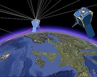 A combination of small satellites can, with innovative methods, use the signals of the navigation satellite systems GPS and Galileo to significantly improve remote sensing of the System Earth. In September the results of a scientific feasibility study on the first MicroGEM satellites, jointly carried out by the Technical University Berlin and the GFZ - German Research Centre for ... read more
 Helsinki, Finland (SPX) Sep 22, 2009
GloPos has announced its software-only positioning technology that makes all mobile phones location aware - outdoors, indoors, and even underground. GloPos Technology requires only a cellular network to make all mobile phones location aware. No additional hardware like GPS or W-LAN is required on a mobile device for achieving accurate positioning. "By making all phones location ... more
|
| |||||||||||||||
| Previous Issues | Sep 21 | Sep 20 | Sep 17 | Sep 16 | Sep 15 |
| . |
 Pasadena CA (SPX) Sep 21, 2009
Opportunity completed the circumnavigation and full-circle imaging of the large meteorite "Block Island" and has resumed the long drive to Endeavour crater. On Sol 2001 (Sept. 9, 2009), the rover moved 9 meters (30 feet) around the meteorite to the fourth and fifth out of six planned positions. On the next sol Opportunity reached the sixth and final position around Block Island with ... more  Greenbelt MD (SPX) Sep 18, 2009
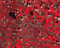
Noreen Thomas' farm looks like a patchwork quilt. Fields change hue with the season and with the alternating plots of organic wheat, soybeans, corn, alfalfa, flax, or hay. Thomas enjoys this view from hundreds of miles above Earth's surface - not just for the beauty, but the utility. She is among a growing group of Midwest farmers who rely on satellite imagery from Landsat to maximize ... more  St. Louis MO (SPX) Sep 18, 2009
A Boeing Harpoon Block II missile equipped with a redesigned Guidance Control Unit (GCU) flew for the first time in a test conducted on Sept. 10. It was launched from the USS Princeton off the coast of California and scored a direct hit on a land-based target on San Nicolas Island, Calif. The new GCU, which controls most of the missile's functions, incorporates a Selective Availability ... more |
. |
|
|
. |
 Newtown PA (SPX) Sep 04, 2009
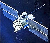
The last in a series of eight modernized Global Positioning System IIR (GPS IIR-M) satellites built by Lockheed Martin has been declared operational by the U.S. Air Force for military and civilian navigation users around the globe. The satellite, known as GPS IIR-21(M), was launched successfully from Cape Canaveral Air Force Station on Aug. 17. Lockheed Martin's operations team assisted ... more  Herndon VA (SPX) Sep 04, 2009
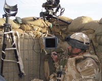
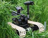
Northrop Grumman's Hunter Unmanned Aircraft System (UAS), in use with the U.S. Army since 1996, has successfully completed testing of the new GPS-guided Viper Strike (VS) weapons system at White Sands Missile Range, N.M. GPS VS will soon deploy to theater on board Hunter in support of contingency operations. GPS VS aides the weapons guidance by providing proximity based on coordinates ... more 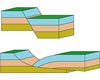 Tempe AZ (SPX) Sep 02, 2009
Some slow-moving faults may help protect some regions of Italy and other parts of the world against destructive earthquakes, suggests new research from The University of Arizona in Tucson. Until now, geologists thought when the crack between two pieces of the Earth's crust was at a very gentle slope, there was no movement along that particular fault line. "This study is the first to ... more |
. |
| Previous Issues | Sep 21 | Sep 20 | Sep 17 | Sep 16 | Sep 15 |
| The contents herein, unless otherwise known to be public domain, are Copyright 1995-2009 - SpaceDaily. AFP and UPI Wire Stories are copyright Agence France-Presse and United Press International. ESA Portal Reports are copyright European Space Agency. All NASA sourced material is public domain. Additional copyrights may apply in whole or part to other bona fide parties. Advertising does not imply endorsement, agreement or approval of any opinions, statements or information provided by SpaceDaily on any web page published or hosted by SpaceDaily. Privacy statement |