|
|
 IKONOS Marks 11 Years On-Orbit
Sunnyvale CA (SPX) Oct 05, 2010 IKONOS, the world's first commercial, high-resolution Earth-imaging satellite, designed and built by Lockheed Martin [NYSE: LMT] and currently operated by GeoEye has achieved 11 years of successful on-orbit operations. A first-of-its-kind satellite, IKONOS was launched on Sept. 24, 1999 to provide high-resolution imagery of the Earth for worldwide commercial and government customers. The spacecraft continues to collect 0.82-meter resolution black-and-white images while simultaneously collecting fo ... read more |
. |
|
|
Free Space, Earth, Energy And Military Newsletters - Delivered Daily |
| . | . |
| .. |
 Arlington VA (AFNS) Sep 15, 2010
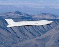
A portable, laser backpack for 3D mapping has been developed at the University of California, Berkeley, where it is being hailed as a breakthrough technology capable of producing fast, automatic and realistic 3D mapping of difficult interior environments. Research leading to the development of the reconnoitering backpack, was funded by the Air Force Office of Scientific Research and the Ar ... more  Pasadena CA (JPL) Sep 15, 2010
NASA and European researchers have conducted a novel study to simultaneously measure, for the first time, trends in how water is transported across Earth's surface and how the solid Earth responds to the retreat of glaciers following the last major Ice Age, including the shifting of Earth's center of mass. To calculate the changes, scientists at NASA's Jet Propulsion Laboratory, Pasadena, ... more  West Lafayette IN (SPX) Sep 15, 2010
After heavy rains and winds from Hurricane Earl pummeled their operations base in St. Croix, Virgin Islands, three Purdue University students continue to collect data as part of a team flying over the tropical Atlantic Ocean to take measurements of what might develop into tropical storm Gaston. Graduate students Alexandria Johnson, Brian Murphy and Paytsar Muradyan are part of a National S ... more |
.. |
 DMCii-Led Project Exploits Satellites To Strengthen UK Disaster Response  The Predictable Events Of The February Earthquake In Chile  Instant online solar energy quotes Solar Energy Solutions from ABC Solar |
.. |
|
|
Free Space, Earth, Energy And Military Newsletters - Delivered Daily |

|
. |
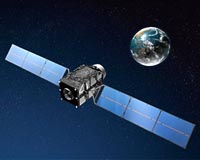
 Japan launches satellite for better GPS coverage
Tokyo (AFP) Sept 11, 2010 Japan on Saturday launched a rocket carrying a satellite intended to improve global positioning systems. The H-IIA rocket blasted off at 8:17pm (1117 GMT) from the Tanegashima space centre in southern Japan, according to the Japan Aerospace Exploration Agency (JAXA). About 30 minutes after the launch, the rocket successfully released the "Michibiki" satellite, whose name means "showing the way". JAXA scientists hope the satellite will boost the accuracy and coverage of GPS, which is widely u ... read more |
| The contents herein, unless otherwise known to be public domain, are Copyright 1995-2010 - SpaceDaily. AFP and UPI Wire Stories are copyright Agence France-Presse and United Press International. ESA Portal Reports are copyright European Space Agency. All NASA sourced material is public domain. Additional copyrights may apply in whole or part to other bona fide parties. Advertising does not imply endorsement, agreement or approval of any opinions, statements or information provided by SpaceDaily on any web page published or hosted by SpaceDaily. Privacy statement |
| Previous Issues | Oct 04 | Oct 01 | Sep 30 | Sep 29 | Sep 28 |