|
 Preparations For First Falcon 9 Test Launch
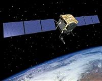
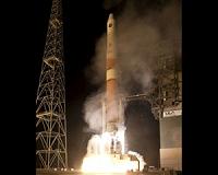
Hawthorne CA (SPX) Jun 03, 2010 SpaceX is now targeting Friday, June 4th for its first test launch attempt of the Falcon 9 launch vehicle. The primary schedule driver for the first Falcon 9 test launch has been certification of the flight termination system (FTS). The FTS ensures that Air Force Range safety officials can command the destruction of the vehicle should it stray from its designated flight path. The successful liftoff of the recent GPS satellite launch last Thursday freed up the necessary Range resources to pro ... read more |
. |
|
|
Free Space, Earth, Energy And Military Newsletters - Delivered Daily |
| . | . |
| .. |
 Paris, France (SPX) May 21, 2010
EADS Defence and Security has introduced the first TEDS data radio in the world. The compact and versatile radio brings unparalleled connectivity and data speed to mission critical communication. Designed for vehicle, office or integrated use, the compact TEDS data radio provides unprecedented possibilities for integration and connectivity. These include the first ever direct IP (Internet ... more  Virginia Key FL (SPX) May 21, 2010
Greenland is situated in the Atlantic Ocean to the northeast of Canada. It has stunning fjords on its rocky coast formed by moving glaciers, and a dense icecap up to 2 km thick that covers much of the island--pressing down the land beneath and lowering its elevation. Now, scientists at the University of Miami say Greenland's ice is melting so quickly that the land underneath is rising at an acce ... more  Washington (UPI) May 19, 2010
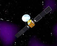
 The U.S. National Oceanic and Atmospheric Administration says it is modernizing its Global Positioning System to utilize advances in technology. Scientists at NOAA's National Geodetic Survey - the official U.S. government source for determining precise latitude, longitude and elevation - said the effort is important for activities requiring accurate positioning information - includin ... more |
.. |
 Radio Tags Could Save Lives After Earthquakes  Delta IV GPS IIF-01 Launch Set May 20  Instant online solar energy quotes Solar Energy Solutions from ABC Solar |
.. |
|
|
Free Space, Earth, Energy And Military Newsletters - Delivered Daily |

|
. |
 NOAA's Modernized Positioning System Key To Improved Mapping, Emergency And Land Planning
Washington DC (SPX) May 17, 2010 NOAA's National Geodetic Survey - the official U.S. government source for determining precise latitude, longitude and elevation - is undergoing a modernization effort that takes into account advances in GPS and other technologies. The effort is important to all activities requiring accurate positioning information including levee construction projects, the design of evacuation routes in hurricane-prone areas and the forecast of sea-level rise in coastal communities. The modernized National S ... read more |
| The contents herein, unless otherwise known to be public domain, are Copyright 1995-2010 - SpaceDaily. AFP and UPI Wire Stories are copyright Agence France-Presse and United Press International. ESA Portal Reports are copyright European Space Agency. All NASA sourced material is public domain. Additional copyrights may apply in whole or part to other bona fide parties. Advertising does not imply endorsement, agreement or approval of any opinions, statements or information provided by SpaceDaily on any web page published or hosted by SpaceDaily. Privacy statement |
| Previous Issues | Jun 02 | Jun 01 | May 31 | May 28 | May 27 |