|
|
Paris, France (SPX) Oct 02, 2009  London, UK (SPX) Oct 02, 2009
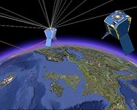
Surrey Satellite Technology Ltd (SSTL) has successfully completed the planned repositioning of the first Galileo test satellite, GIOVE-A, to a higher orbit to make way for the operational satellites of Europe's satellite navigation constellation. From the GIOVE-A operational headquarters in Guildford, UK, SSTL's operating team executed a series of precisely planned manoeuvres during July ... more
|
| |||||||||||||||
| Previous Issues | Oct 01 | Sep 30 | Sep 29 | Sep 28 | Sep 27 |
| . |
 Tucson AZ (SPX) Oct 02, 2009
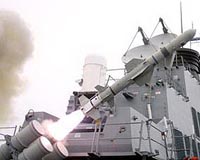
Raytheon delivered the first Joint Standoff Weapon C to Australia in July for the Royal Australian Air Force's new F/A-18F Hornet fighter aircraft. In addition to the JSOW C, the RAAF has placed an order for the JSOW C-1, which is currently in production; deliveries will begin in 2010. The JSOW C-1 maintains the land attack capability of JSOW C and adds a moving maritime target capability ... more  Herndon VA (SPX) Oct 02, 2009
Northrop Grumman has equipped and fielded its Hunter Unmanned Aircraft System (UAS) with an Automatic Takeoff and Landing System (ATLS) to the Army's UAS Training Battalion, Fort Huachuca, Ariz., where it successfully completed its first launch and recovery. Hunter, which has been in use with the Army since 1996, was originally designed using an External Pilot (EP) for take-offs and ... more  Redlands CA (SPX) Oct 01, 2009
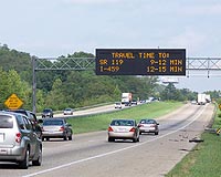
The Eugene Police Department (EPD) in Oregon has transformed how it takes advantage of maps and related data throughout the agency, deploying powerful desktop and Web geographic information systems (GIS) to more effectively carry out law enforcement tasks. EPD links its records management data, computer-aided dispatch data, and information from other sources to an easily shared information ... more |
. |
|
|
. |
 Moscow, Russia (RIA Novosti) Sep 23, 2009
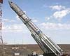
Russia's launch of a Proton-M carrier rocket from the Baikonur space center has been delayed due to a problem with one of Glonass-M satellites, a source at the launch facility in Kazakhstan said Tuesday. The source said that the decision to delay the launch from Friday until a later date was "made not at the space center but in Moscow, at [Russian Space Agency] Roscosmos." ... more General Dynamics Ordnance and Tactical Systems has announced that it has successfully developed and tested a new approach for low-cost guided mortars called the 120mm Roll-Controlled Guided Mortar (RCGM). Under a cooperative research and development agreement with the U.S. Army TACOM-ARDEC, Picatinny Arsenal, N.J., General Dynamics successfully tube-launched and guided RCGM prototypes from ... more 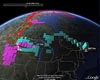 Ann Arbor MI (SPX) Sep 23, 2009
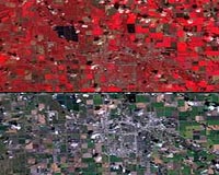
Sometimes a picture really is worth a thousand words, particularly when the picture is used to illustrate science. Technology is giving us better pictures every day, and one of them is helping a NASA-funded scientist and her team to explain the behavior of a greenhouse gas. Google Earth - the digital globe on which computer users can fly around the planet and zoom in on key features - is ... more |
. |
| Previous Issues | Oct 01 | Sep 30 | Sep 29 | Sep 28 | Sep 27 |
| The contents herein, unless otherwise known to be public domain, are Copyright 1995-2009 - SpaceDaily. AFP and UPI Wire Stories are copyright Agence France-Presse and United Press International. ESA Portal Reports are copyright European Space Agency. All NASA sourced material is public domain. Additional copyrights may apply in whole or part to other bona fide parties. Advertising does not imply endorsement, agreement or approval of any opinions, statements or information provided by SpaceDaily on any web page published or hosted by SpaceDaily. Privacy statement |