|
|
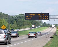
Redlands CA (SPX) Oct 01, 2009  The Eugene Police Department (EPD) in Oregon has transformed how it takes advantage of maps and related data throughout the agency, deploying powerful desktop and Web geographic information systems (GIS) to more effectively carry out law enforcement tasks. EPD links its records management data, computer-aided dispatch data, and information from other sources to an easily shared information ... read more
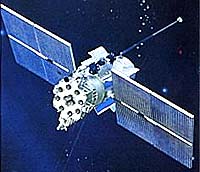
Boeing has completed developmental system testing on the U.S. Air Force's Global Positioning System (GPS) satellite ground control system, known as the Operational Control Segment (OCS), for the addition of a critical new security capability. The test demonstrated that the Selective Availability Anti-Spoofing Module (SAASM) software upgrade meets all contractual system requirements. SAASM ... more
|
| |||||||||||||||
| Previous Issues | Sep 30 | Sep 29 | Sep 28 | Sep 27 | Sep 24 |
| . |
 Wichita, Kan. (UPI) Sep 29, 2009
 The B-52 aircraft deployed as part of the U.S. Air Force fleet are to be equipped with secure Extremely High Frequency Communication Systems to enable them to remain in contact with other elements of the military in space, in the air and on the ground. The revolutionary EHF has been found to be more reliable and less susceptible to atmospheric conditions than other frequencies. ... more  Paris (AFP) Sept 27, 2009
People who were killed, injured or bereaved in the 2008 Sichuan earthquake had the cruel misfortune to be victims of an event that probably occurs just once in four millennia, seismologists said on Sunday. In a paper published in the journal Nature Geoscience, Shen Zhengkang of the China Earthquake Administration and colleagues said the May 12, 2008 quake comprised a strong seismic wave ... more  Denver CO (SPX) Sep 28, 2009
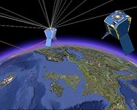
The world's first commercial, high-resolution, Earth imaging satellite, IKONOS, will achieve its 10th year of operation on Sept. 24. Built by Lockheed Martin, the satellite continues to provide high-resolution imagery of the Earth to commercial and government customers around the world. IKONOS is owned and operated by GeoEye of Dulles, Va. "When we launched IKONOS in ... more |
. |
|
|
. |
 Helsinki, Finland (SPX) Sep 22, 2009
GloPos has announced its software-only positioning technology that makes all mobile phones location aware - outdoors, indoors, and even underground. GloPos Technology requires only a cellular network to make all mobile phones location aware. No additional hardware like GPS or W-LAN is required on a mobile device for achieving accurate positioning. "By making all phones location ... more  Pasadena CA (SPX) Sep 21, 2009
Opportunity completed the circumnavigation and full-circle imaging of the large meteorite "Block Island" and has resumed the long drive to Endeavour crater. On Sol 2001 (Sept. 9, 2009), the rover moved 9 meters (30 feet) around the meteorite to the fourth and fifth out of six planned positions. On the next sol Opportunity reached the sixth and final position around Block Island with ... more  Greenbelt MD (SPX) Sep 18, 2009
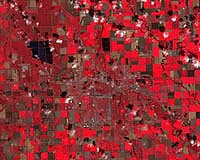
Noreen Thomas' farm looks like a patchwork quilt. Fields change hue with the season and with the alternating plots of organic wheat, soybeans, corn, alfalfa, flax, or hay. Thomas enjoys this view from hundreds of miles above Earth's surface - not just for the beauty, but the utility. She is among a growing group of Midwest farmers who rely on satellite imagery from Landsat to maximize ... more |
. |
| Previous Issues | Sep 30 | Sep 29 | Sep 28 | Sep 27 | Sep 24 |
| The contents herein, unless otherwise known to be public domain, are Copyright 1995-2009 - SpaceDaily. AFP and UPI Wire Stories are copyright Agence France-Presse and United Press International. ESA Portal Reports are copyright European Space Agency. All NASA sourced material is public domain. Additional copyrights may apply in whole or part to other bona fide parties. Advertising does not imply endorsement, agreement or approval of any opinions, statements or information provided by SpaceDaily on any web page published or hosted by SpaceDaily. Privacy statement |