|
|
St. Louis MO (SPX) Sept 01, 2009 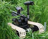 Boeing will demonstrate its ground robotics capabilities at the U.S. Army's first Robotics Rodeo, to be held Sept. 1-3 at Fort Hood, Texas. The event is sponsored by the Army's Tank Automotive Research, Development and Engineering Center (TARDEC) and Fort Hood's III Corps. The event is an opportunity for industry to demonstrate to Army and government officials how the latest robotic ... read more
 Kampala (AFP) Aug 31, 2009
Users of the social networking sites Facebook and Twitter will be able to "befriend" rare Ugandan mountain gorillas and track their movements, a Wildlife Authority spokeswoman said Monday. In a scheme designed to promote Uganda's nascent tourism industry, users will receive regular updates about their endangered primate friends, Lillian Nsubuga told AFP. "Through geo-tracking and GPS ... more
|
| |||||||||||||||
| Previous Issues | Aug 31 | Aug 30 | Aug 28 | Aug 27 | Aug 26 |
| . |
 Blacksburg VA (SPX) Aug 31, 2009
Members of Virginia Tech's Space@VT research group are receiving a $2 million grant from the National Science Foundation (NSF) to build a chain of space weather instrument stations in Antarctica. Space weather affects a variety of everyday consumer technologies including global positioning systems (GPS), satellites for television reception, and cellular phones. Also, the understanding of space ... more  Washington DC (SPX) Aug 28, 2009
With a very lucky shot, scientists have captured a one-second image and the electrical fingerprint of huge lightning that flowed 40 miles upward from the top of a storm. These rarely seen, highly charged meteorological events are known as gigantic jets, and they flash up to the lower levels of space, or ionosphere. While they don't occur every time there is lightning, they are ... more  Sunnyvale CA (SPX) Aug 28, 2009
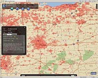
Trimble has introduced the Trimble AllTrak Asset Management System for contractors to manage their construction equipment and tools such as drills, ladders, compressors, nailers, and consumables. With accurate tracking information about asset usage, contractors can increase their efficiency while confidently managing acquisition, maintenance, and eventual retirement of their tools, equipment, an ... more |
. |
|
|
. |
 Washington DC (SPX) Aug 21, 2009
Air Force Space Command activated a new unit yesterday to better organize space and cyberspace capabilities and to keep pace with the rapid changes in information technology, the Space Command's top military officer said. The 24th Air Force, activated at a ceremony at Lackland Air Force Base, Texas, provides the Air Force with one operational command for the entire tactical space and cyber ... more  Baltimore MD (SPX) Aug 21, 2009
Northrop Grumman has been selected by the U.S. Army to finalize development of its Distributed Common Ground System-Army (DCGS-A) Mobile Basic system, specifically for the Army's emerging Brigade Combat Teams (BCTs). Valued at $296 million, this continuation development contract covers a total performance period of 30 months. This critical upgrade to DCGS-A consolidates the Army's current ... more  Newtown PA (SPX) Aug 21, 2009
The JCSAT-12 communications satellite, designed and built by Lockheed Martin for SKY Perfect JSAT Corporation (SKY Perfect JSAT) of Japan, is ready for its scheduled launch on Aug. 21 aboard an Ariane 5-ECA launch vehicle provided by Arianespace. The launch window opens at 6:09 p.m. EDT and closes at 7:09 p.m. EDT. JCSAT-12 is a high-power hybrid satellite consisting of 30 active Ku-band ... more |
. |
| Previous Issues | Aug 31 | Aug 30 | Aug 28 | Aug 27 | Aug 26 |
| The contents herein, unless otherwise known to be public domain, are Copyright 1995-2009 - SpaceDaily. AFP and UPI Wire Stories are copyright Agence France-Presse and United Press International. ESA Portal Reports are copyright European Space Agency. All NASA sourced material is public domain. Additional copyrights may apply in whole or part to other bona fide parties. Advertising does not imply endorsement, agreement or approval of any opinions, statements or information provided by SpaceDaily on any web page published or hosted by SpaceDaily. Privacy statement |