|
|
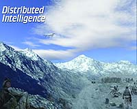
Blacksburg VA (SPX) Aug 31, 2009 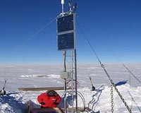 Members of Virginia Tech's Space@VT research group are receiving a $2 million grant from the National Science Foundation (NSF) to build a chain of space weather instrument stations in Antarctica. Space weather affects a variety of everyday consumer technologies including global positioning systems (GPS), satellites for television reception, and cellular phones. Also, the understanding of space ... read more
 Washington DC (SPX) Aug 28, 2009
With a very lucky shot, scientists have captured a one-second image and the electrical fingerprint of huge lightning that flowed 40 miles upward from the top of a storm. These rarely seen, highly charged meteorological events are known as gigantic jets, and they flash up to the lower levels of space, or ionosphere. While they don't occur every time there is lightning, they are ... more
|
| |||||||||||||||
| Previous Issues | Aug 30 | Aug 28 | Aug 27 | Aug 26 | Aug 25 |
| . |
 Sunnyvale CA (SPX) Aug 28, 2009
Trimble has introduced the Trimble AllTrak Asset Management System for contractors to manage their construction equipment and tools such as drills, ladders, compressors, nailers, and consumables. With accurate tracking information about asset usage, contractors can increase their efficiency while confidently managing acquisition, maintenance, and eventual retirement of their tools, equipment, an ... more  Redlands CA (SPX) Aug 28, 2009
States searching for a way to participate in the U.S. State Broadband Data and Development Program now have a solution with BroadbandStat, ESRI's new Web application that provides tools for mapping broadband coverage and planning broadband initiatives. Federal broadband stimulus funds available in the United States offer an unprecedented opportunity for states to improve their broadband in ... more Epitiro has launched ISP-I WiMAX Drive Test for network operators and government regulators. The new mobile functionality links WiMAX network test results with critical GPS location information to provide an understanding of overall performance throughout geographical areas. ISP-I WiMAX Drive Test is ideal for planning mast placement and identifying "not-spots" in target areas as it provid ... more |
. |
|
|
. |
 Newtown PA (SPX) Aug 21, 2009
The JCSAT-12 communications satellite, designed and built by Lockheed Martin for SKY Perfect JSAT Corporation (SKY Perfect JSAT) of Japan, is ready for its scheduled launch on Aug. 21 aboard an Ariane 5-ECA launch vehicle provided by Arianespace. The launch window opens at 6:09 p.m. EDT and closes at 7:09 p.m. EDT. JCSAT-12 is a high-power hybrid satellite consisting of 30 active Ku-band ... more  San Francisco (AFP) Aug 18, 2009
SmartZip has built a free online tool for prospective home buyers and real estate investors eager to mine gems from the rubble of the US foreclosure avalanche. Engineers at newly-launched SmartZip.com crafted software to rate the appreciation potential of homes by analyzing job trends, population growth, crime statistics, school districts, real estate price patterns and more. The result ... more  Cape Canaveral FL (SPX) Aug 18, 2009
The 48th successful and final Air Force Delta II Global Positioning System satellite launch occurred today, ending one of the most successful space launch programs in American history. A United Launch Alliance Delta II rocket launched GPS IIR-21(M) into orbit from Space Launch Complex-17A at 6:35 a.m., EDT today. The first Air Force Delta II GPS launch occurred Feb. 14, 1989 and today's ... more |
. |
| Previous Issues | Aug 30 | Aug 28 | Aug 27 | Aug 26 | Aug 25 |
| The contents herein, unless otherwise known to be public domain, are Copyright 1995-2009 - SpaceDaily. AFP and UPI Wire Stories are copyright Agence France-Presse and United Press International. ESA Portal Reports are copyright European Space Agency. All NASA sourced material is public domain. Additional copyrights may apply in whole or part to other bona fide parties. Advertising does not imply endorsement, agreement or approval of any opinions, statements or information provided by SpaceDaily on any web page published or hosted by SpaceDaily. Privacy statement |