|
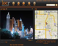
Boston MA (SPX) Mar 05, 2008 locr and Skyhook Wireless have announced a partnership to bring Wi-Fi positioning to locr's geo-tagging community. This ground-breaking partnership will bring location awareness for photos to millions of Wi-Fi handsets and also improve the accuracy and availability of location information for a significant number of existing locr users. "Geo-tagging, or marking photos with precise location information, is poised to move into the mainstream," said IMS Research Analyst Matia Grossi. "Today, camera and cell phone makers are exploring ways to support geo-tagging in their devices." One innovative way to bring location capabilities to devices is GPS. However, GPS can sometimes have issues with coverage indoors and with accuracy in urban environments and around tall buildings. Combining Skyhook Wireless' Wi-Fi Positioning System along with GPS addresses many of these problems by optimizing location accuracy, coverage, and time to fix in the environments where GPS is weakest. In addition, the WPS provides geo-tagging capabilities for devices that support Wi-Fi but do not have other location technology. locr is positioned to benefit from the surge in interest for tagging photos with location information. locr provides everything necessary to geo-tag digital photos: free software for PC and mobile, free webspace, community and organization features and now, the first solution for GPS and Wi-Fi photo geo-tagging. Today the locr community is able to visit historic places, meet new people, and explore both the neighborhood and the world by browsing for and reviewing photos on a map. In addition, these users are finding that using precise location information in photos is a very effective tool for classifying and managing increasingly large on- and off-line libraries of photos. "Integrating WPS into the locr solution will significantly expand the number of handsets that support geo-tagging," said Mike Shean, vice president of business development for Skyhook Wireless. "For existing locr users that have Wi-Fi enabled devices, the upgraded locr application will increase the accuracy and availability of geo-tagging in all of the places where people take pictures." "locr is happy to announce this partnership with Skyhook Wireless in order to enable the geo-tagging of photos with Wi-Fi in addition to GPS," said Malte Schloen, CEO of locr GmbH. "Geo-tagging is revolutionizing the culture of photography and Skyhook is the perfect addition to augment existing location technology and to bring location awareness to existing and future Wi-Fi enabled cameras and cell phones." Related Links locr GPS Applications, Technology and Suppliers
 Moscow (UPI) Mar 04, 2008
The development of Russia's high-tech sector, primarily the national space program, resembles a Camel Trophy race, while official reports do not always reflect the real situation. |
|
| The content herein, unless otherwise known to be public domain, are Copyright Space.TV Corporation. AFP and UPI Wire Stories are copyright Agence France-Presse and United Press International. ESA Portal Reports are copyright European Space Agency. All NASA sourced material is public domain. Additional copyrights may apply in whole or part to other bona fide parties. Advertising does not imply endorsement, agreement or approval of any opinions, statements or information provided by Space.TV Corp on any Web page published or hosted by Space.TV Corp. Privacy Statement |