|
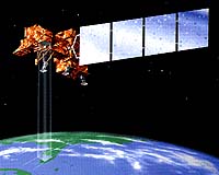
Reston VA (SPX) Apr 05, 2007 Scientists and engineers from the Department of the Interior's U.S. Geological Survey (USGS) and NASA are moving forward in planning a successor to the Landsat 7 satellite mission. With the Landsat Data Continuity Mission (LDCM) satellite expected to launch in 2011, the two agencies have announced their roles and responsibilities in mission development, subsystems procurement, and on-orbit operations. NASA and USGS share responsibility for the LDCM. NASA will procure and/or develop the space segment, consisting of the satellite, instrument, and launch services and will also perform on-orbit satellite checkout. The USGS will develop and implement the ground segment, consisting of the ground receiving station network, a satellite operations facility, and archive and image processing facilities. After launch and check-out, NASA will transfer the satellite to the USGS to perform flight operations, image-data capture and archiving, and product dissemination. The USGS will use NASA procurement services to acquire mission operations software for commanding the satellite and instrument, thus ensuring compatibility with NASA's space segment procurement. The USGS will competitively procure ground segment resources, including the primary ground receiving station at the USGS EROS Center near Sioux Falls, South Dakota, as well as supplemental capabilities to ensure comprehensive and timely global data acquisition. The data-collection planning capability will be modeled after the successful Landsat 7 Long-Term Acquisition Plan to collect global land image data and will be developed through the USGS EROS Technical Support Services Contract. The mission operations facility will be configured at the USGS EROS Center through commercial facility modification contracts. The flight operations team will also be procured competitively, similar to the approach employed for the Landsat 5 and 7 missions. Data archive and user portal capabilities will be procured competitively, while image processing functionality will be developed through the USGS EROS Technical Support Services Contract. Independent ground systems architecture analysis and integration will be led by the USGS and supported by Federally-Funded Research and Development Center resources. Finally, overall system integration into the existing USGS infrastructure will be ensured through the USGS EROS Technical Support Services Contract. Related Links Landsat Data Continuity Mission Making money out of watching earth from space today Earth Observation News - Suppiliers, Technology and Application
 Paris, France (SPX) Apr 02, 2007
Today ESA Director General Jean-Jacques Dordain and Her Excellency Ms Sarah Dennis, New Zealand's Ambassador to France, signed an arrangement on the installation of a transportable telemetry station to track the Ariane 5 launcher that will carry into orbit ESA's Automated Transfer Vehicle (ATV) for its maiden flight in autumn this year. |
|
| The content herein, unless otherwise known to be public domain, are Copyright Space.TV Corporation. AFP and UPI Wire Stories are copyright Agence France-Presse and United Press International. ESA Portal Reports are copyright European Space Agency. All NASA sourced material is public domain. Additional copyrights may apply in whole or part to other bona fide parties. Advertising does not imply endorsement, agreement or approval of any opinions, statements or information provided by Space.TV Corp on any Web page published or hosted by Space.TV Corp. Privacy Statement |