GPS News  
Real-Time Corrections Service For In-the-Field High-Accuracy Mapping

-
by Staff Writers
Sunnyvale CA (SPX) Jul 18, 2008
Trimble has introduced a significant advancement in high-accuracy, in-the-field mapping with its new Trimble VRS Now H-Star service. This revolutionary service provides instant access to H-Star corrections throughout Germany, Great Britain, and the Madrid region of Spain.

A subscription to the Trimble VRS Now H-Star service gives users working in utilities, local government, natural resources, and land management the ability to obtain real-time, decimeter level accurate positions consistently and directly at the job site.

With instant access to H-Star corrections on demand, field workers can be more efficient and high-accuracy mapping projects can be up and running in minutes to increase productivity.

By accessing proven Trimble VRS technology, subscribers can correct data in the field without setting up base stations, and there is no need for post processing data.

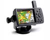
Mapping and Geographic Information System (GIS) professionals with the Trimble H-Star compatible GPS receivers -- the GeoXH2008 series handheld receiver or GPS Pathfinder ProXRT receiver -- can take advantage of the service.

"Utilities personnel and other asset management professionals are under increasing pressure to complete high-accuracy mapping projects even more quickly," said Pierre Desjardins, manager for Trimble's GNSS Infrastructure business area.

"Users equipped only with a GPS receiver, a cellular connection and a subscription to the Trimble service can overcome these challenges in the field by tapping into the new H-Star corrections."

In addition, teaming the GPS Pathfinder ProXRT receiver with the Trimble Nomad series of handhelds (800XC and 800XE models) removes the need for a separate phone.

The Trimble Nomad handheld's integrated cellular modem allows users to connect directly from the handheld to the Trimble VRS Now H-Star service for optimal performance with a minimal hardware investment. With the GPS Pathfinder ProXRT receiver, users can also install the GLONASS option, which increases the number of GNSS satellites that can be accessed.

Related Links
Trimble VRS Now H-Star
GPS Applications, Technology and Suppliers


Memory Foam Mattress Review
Newsletters :: SpaceDaily :: SpaceWar :: TerraDaily :: Energy Daily
XML Feeds :: Space News :: Earth News :: War News :: Solar Energy News


San Diego State University Improves MEMS Accelerometer Tunability
San Diego CA (SPX) Jul 16, 2008
Researchers at San Diego State University have developed a new concept for improving MEMS accelerometer tunability. This method can increase wide-band tunability with ranges much larger than current practice, a significant improvement from the previously accepted 5-10%.


  • British PM blasts polluting 'ghost' flights
  • Air China says it is to buy 45 Boeing aircraft
  • Raytheon Leads Team To Evaluate Impact Of New Classes Of Aircraft For NASA
  • Bombardier launches 'green' aircraft programme

  • Off-peak electricity could power hybrids
  • Lasers, Software And The Devil's Slide
  • Future Of Transit Taking Shape At The Big Blue Bus
  • Fuel For Thought On Transport Sector Challenges

  • DRS Completes Testing Of PMM System
  • Boeing To Demo Net-Centric Upgrade On AWACS Aircraft
  • Satellite's Instrumentation Providing Scintillation Forecast Data
  • USAF E-8C Joint STARS Airframes Operationally Viable Through 2070

  • BMD Watch: PAC upgrade orders for Raytheon
  • US missile defense test delayed until December
  • Russian opposition to missile defense unjustified: US general
  • What Should Russia Do To Counter US Missile Defense In Europe

  • Brazil agribusiness wants looser ties to China, India in WTO talks
  • River Damming Leads To Dramatic Decline In Native Fish Numbers
  • China trade deficit in food up 14-fold: report
  • China to urgently boost GM crop development

  • China quake zone govt to sell luxury HQ after outcry: report
  • China quake sends 1.4 million back into poverty: report
  • Asia sets stage for disaster relief exercise with key powers
  • Exercise For Rapid Disaster Relief Using Space-Based Technologies

  • Satellite Users Group Opposes UTC Request
  • EchoStar XI Satellite Deploys Solar Arrays On Schedule
  • Eutelsat W5 Satellite Performance Stabilised
  • Integral To Provide Carrier Monitoring And Interference Detection Capability To Telenor

  • NASA Robots Perform Well During Arctic Ice Deployment Testing
  • Eight Teams Taking Up ESA's Lunar Robotics Challenge
  • Three Engineers, Hundreds of Robots, One Warehouse
  • Tartalo The Robot Is Knocking On Your Door

  • The content herein, unless otherwise known to be public domain, are Copyright Space.TV Corporation. AFP and UPI Wire Stories are copyright Agence France-Presse and United Press International. ESA Portal Reports are copyright European Space Agency. All NASA sourced material is public domain. Additional copyrights may apply in whole or part to other bona fide parties. Advertising does not imply endorsement, agreement or approval of any opinions, statements or information provided by Space.TV Corp on any Web page published or hosted by Space.TV Corp. Privacy Statement