 |
Woodland Hills CA (SPX) Feb 25, 2011 Northrop Grumman, in partnership with the University of Minnesota, has been selected to develop a collaborative navigation system under the U.S. Air Force Research Laboratory's (AFRL) Collaborative Robust Integrated Sensor Positioning Program. Collaborative navigation will allow aircraft to leverage information from their onboard sensors in addition to shared data from other aircraft to achieve highly accurate navigation performance in all flight conditions, even in areas where global positioning system (GPS) information is unavailable. During the initial award period, Northrop Grumman and the University of Minnesota will develop algorithms that will enable the collaborative navigation system to operate across multiple aircraft platforms. By sharing relative positioning information, video, geo-registered imagery, and other navigation data using the net-centric communication capabilities on the platforms, the collaborative navigation system will improve overall navigational accuracy. "Extending current methods of own-ship navigation to a collaborative environment will offer tangible benefits to the warfighter by providing highly accurate navigation information in all environments, with or without GPS assistance," said Charles Volk, vice president and chief technology officer of Northrop Grumman's Navigation Systems Division. "The collaborative navigation solution that Northrop Grumman and the University of Minnesota have developed represents state-of-the-art and innovative use of net-centric operations and layered sensing for navigation." AFRL's Collaborative Robust Integrated Sensor Positioning program seeks to develop navigation technologies to improve situational awareness of the warfighter in all operating conditions. Northrop Grumman, in partnership with the University of Minnesota, was awarded a research and development contract for the preliminary design of collaborative navigation algorithms. Future phases of the program will include the development of a real-time prototype collaborative navigation system and a flight test demonstration.
Share This Article With Planet Earth
Related Links - GPS Applications, Technology and Suppliers
 Lockheed Martin-Built GPS Satellite Exceeds 10 Years On-Orbit
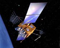
Newtown PA (SPX) Feb 16, 2011 The seventh Global Positioning System Block IIR (GPS IIR-7/SVN-54) satellite, designed and built by Lockheed Martin [NYSE: LMT], has reached 10 years of successful on-orbit operations, and continues to deliver critical position, navigation and timing (PNT) signals to nearly one billion GPS users worldwide. The satellite, launched on January 30, 2001 and declared operational on February 15, ... read more |
|
| The content herein, unless otherwise known to be public domain, are Copyright 1995-2010 - SpaceDaily. AFP and UPI Wire Stories are copyright Agence France-Presse and United Press International. ESA Portal Reports are copyright European Space Agency. All NASA sourced material is public domain. Additional copyrights may apply in whole or part to other bona fide parties. Advertising does not imply endorsement,agreement or approval of any opinions, statements or information provided by SpaceDaily on any Web page published or hosted by SpaceDaily. Privacy Statement |