|
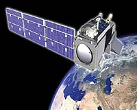
Redondo Beach CA (SPX) Jul 31, 2007 Northrop Grumman, in conjunction with the government's tri-agency NPOESS Integrated Program Office, has completed the restructure of the National Polar-orbiting Operational Environmental Satellite System (NPOESS). This restructure represents a rigorous year-long effort to re-plan virtually every aspect of the NPOESS program following its certification and restructuring through the Nunn McCurdy process in 2006. The plan details the development and delivery of the system through initial production in the next decade. Northrop Grumman is the prime contractor for the next generation of low-Earth orbiting environmental, climate and weather-monitoring satellites. "The restructure puts NPOESS on a solid footing," said Alexis Livanos, corporate vice president and president of Northrop Grumman's Space Technology sector. "With the program now successfully restructured, NPOESS is moving ahead to meet the operational weather, environmental and climate monitoring requirements of civilian and military users. The system will also satisfy more than half of the essential climate variables needed by the world's climatologists." Throughout the extensive planning effort, the Northrop Grumman-led team has continued to meet scheduled milestones. As a result, NPOESS has been on cost and on schedule for the past 21 months. Significant progress has been made, including: + Completing testing on the Visible/Infrared Imager Radiometer Suite (VIIRS) engineering development model and starting integrated sensor testing on the VIIRS first flight unit; + Completing key NPP spacecraft temperature and ambient tests; + Developing initial versions of all the end-product environmental data record algorithms; + Successfully commanding the NPP spacecraft using the NPOESS/NPP command, communication and control system in NOAA's Satellite Operations Facility; + Completing development of the satellite and ground control system for the NPOESS Preparatory Project (NPP), a risk reduction mission; + Completing four out of five planned iterations of the ground mission data processing software. With its climate monitoring capability, NPOESS will be the cornerstone for global environmental monitoring in the coming decades. The United States will supplement observations from NPOESS with data provided by the European Organization for the Exploitation of Meteorological Satellites (EUMETSAT) series of MetOp satellites. The current schedule calls for the NPOESS Preparatory Project, a risk reduction satellite flying NPOESS sensors, to be launched in 2009 and for the first NPOESS satellite to be launched in 2013. NPOESS is designed to host a wide variety of sensors on a common spacecraft bus. The satellites have power and deck space along with high data throughput and extremely accurate pointing and stability to accommodate all de-manifested sensors and new sensors while minimizing cost and risk to mission. The program plan has also been restructured to allow time for integration of the de-manifested sensors, as requested. The re-structured NPOESS system consists of two spacecraft, nine sensors and associated calibration and validation (including NPOESS Preparatory Project sensors), 15 Safety Net(tm) receptor sites, the command, communication and control system, ground processing, and operations through 2016. Sensors manifested on NPOESS and the NPOESS Preparatory Project include: + Visible/Infrared Imager Radiometer Suite (VIIRS). Collects visible and infrared radiometric data of the Earth's atmosphere, ocean, and land surfaces. Data types include atmospheric, clouds, Earth radiation budget, land/water and sea surface temperature, ocean color, and low light imagery. + Microwave Imager/Sounder (MIS). Collects microwave radiometry and sounding data. + Crosstrack Infrared Sounder (CrIS). Measures Earth's radiation to determine the vertical distribution of temperature, moisture, and pressure in the atmosphere. + Advanced Technology Microwave Sounder (ATMS). In conjunction with CrIS, collects global observations of temperature and moisture profiles at high temporal resolution. + Ozone Mapping and Profiler Suite (OMPS-Nadir and Limb). Collects data to permit the calculation of the vertical and horizontal distribution of ozone in the Earth's atmosphere. + Data Collection System (A-DCS). Measures environmental factors such as atmospheric temperature and pressure and the velocity and direction of the ocean and wind currents. + Clouds and the Earth's Radiant Energy System (CERES). Measures both solar-reflected and Earth-emitted radiation from the top of the atmosphere to the Earth's surface. + Search and Rescue Satellite Aided Tracking. Uses NOAA satellites in low-Earth and geostationary orbits to detect and locate aviators, mariners, and land-based users in distress. + Space Environment Monitor (SEM). Measures the near-Earth space environment in terms of neutral and charged particles, electron and magnetic fields. Related Links Northrop Grumman Military Space News at SpaceWar.com
 Buenos Aires (AFP) Jul 24, 2007
Argentina's tax authorities are using satellite images generated on the Internet by Google Earth to track down fraud, local media said Friday. According to Buenos Aires province tax official Santiago Montoya, images of properties from the sky can help square the actual size of properties with that declared by taxpayers to make sure the proper amount of taxes is being paid, the reports said. |
|
| The content herein, unless otherwise known to be public domain, are Copyright Space.TV Corporation. AFP and UPI Wire Stories are copyright Agence France-Presse and United Press International. ESA Portal Reports are copyright European Space Agency. All NASA sourced material is public domain. Additional copyrights may apply in whole or part to other bona fide parties. Advertising does not imply endorsement, agreement or approval of any opinions, statements or information provided by Space.TV Corp on any Web page published or hosted by Space.TV Corp. Privacy Statement |