GPS News  
GeoEye-1 Snaps Democracy

GeoEye-1, the world's highest resolution commercial Earth-imaging satellite, collected this image over the United States Capitol and the Inauguration of President Barack Obama. The image, taken from 423 miles in space, is the world's highest resolution, color satellite image of the Inaugural celebration. The image, taken through high, whispy white clouds over Washington D.C., shows the monuments along the National Mall and masses of people between the Capitol and the Lincoln Memorial. For more images please go here (PRNewsFoto/GeoEye, Inc.)
by Staff Writers
Dulles VA (SPX) Jan 23, 2009
At 11:19 a.m. (EST) GeoEye-1, the world's highest resolution commercial Earth-imaging satellite, collected an image over the United States Capitol and the Inauguration of President Barack Obama. The image, taken from 423 miles in space, is the world's highest resolution, color satellite image of the Inaugural celebration.

The image, taken through high, whispy white clouds over Washington D.C., shows the monuments along the National Mall and masses of people between the Capitol and the Lincoln Memorial. Among the many interesting features in the image are the clusters of people gathered around large jumbotron screens.

The image was taken by GeoEye's newest satellite, GeoEye-1, as it moved from north to south along the eastern seaboard of the United States traveling at 17,000 mph or about four miles per second.

GeoEye-1 is the world's highest resolution commercial Earth imaging satellite. It is able to discern objects on the ground as small as 0.41-meter or about 16 inches in size, which represents an object about the size of home plate on a baseball diamond.

However, due to current U.S. licensing restrictions the imagery is re-sampled to half-meter ground resolution. The satellite is currently in its final stages of check-out and calibration. The 4,300-pound satellite was launched from Vandenberg Air Force Base, Calif. on Sept. 6, 2008.

GeoEye is making the imagery available at no cost. It is downloadable from the Company's website at www.geoeye.com under Featured Images. It may be used as long as there is a clear and distinct photo credit of: "GeoEye Satellite Image."

Related Links
- Earth Observation News - Suppiliers, Technology and Application


Memory Foam Mattress Review
Newsletters :: SpaceDaily :: SpaceWar :: TerraDaily :: Energy Daily
XML Feeds :: Space News :: Earth News :: War News :: Solar Energy News


ABB Interferometer Rides On Board GOSAT
Quebec City, Canada (SPX) Jan 23, 2009
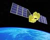
ABB is pleased to see the final phase of the GOSAT (Greenhouse Gases Observing Satellite) project come to fruition. The principal component of the Japanese satellite is a spatial interferometer developed by ABB.


  • New Turbines Can Cut Fuel Consumption For Business Jets
  • Air China expects to post 'significant loss' for 2008
  • Nations demand climate plan from air, maritime industries
  • Cathay defers completion of new cargo terminal due to downturn

  • Over 91,000 killed in China in accidents in 2008: report
  • Ford starts making Fiesta in China
  • China 2008 auto sales growth slows to eight percent: state media
  • Recession got you down? Buy a hybrid

  • TSAT Set To Speed Up Data Rates Across The Air Force
  • Increasing Joint Battlefield Operation Effectiveness
  • Australia Chips In A Spare Quarter For Boeing Wideband Global SATCOM Bird
  • Boeing Completes Critical Design Review For FAB-T Software-Defined Radio

  • Club Of Nine Gives Missile Defense A Boost Part One
  • Outside View: BMD priorities -- Part 5
  • BMD Watch: New SBIRS software tested
  • Obama Takes The Football And Mitt Part Four

  • China milk verdicts show govt fixing safety woes: state media
  • Two sentenced to death over China milk scandal
  • Argentina faces farm emergency amid devastating drought
  • Liberian insect plague devastates farms

  • Myanmar cyclone, China quake dominate global disaster toll: UN
  • Indonesia braces for flood-related diseases
  • China to rebuild quake town, call it 'Eternal Prosperity': state media
  • As lightning deaths soar, Cambodians look to superstition

  • Heating Up Gold To Surprising Effect: It Gets Harder Not Softer
  • Raytheon Sensor Passes Space Simulation Test
  • Next Generation Cloaking Device Demonstrated
  • Lockheed Martin Begins Key Test Of First SBIRS Geo Satellite With New Flight Software

  • AF Officials Look At Robots For Aircraft Ground Refueling
  • Japan researchers unveil robot suit for farmers
  • Will GI Roboman Replace GI Joe
  • Marshall Sponsors Four Student Teams In FIRST Robotics Competitions

  • The content herein, unless otherwise known to be public domain, are Copyright Space.TV Corporation. AFP and UPI Wire Stories are copyright Agence France-Presse and United Press International. ESA Portal Reports are copyright European Space Agency. All NASA sourced material is public domain. Additional copyrights may apply in whole or part to other bona fide parties. Advertising does not imply endorsement, agreement or approval of any opinions, statements or information provided by Space.TV Corp on any Web page published or hosted by Space.TV Corp. Privacy Statement