|
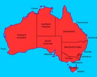
San Luis Obispo CA (SPX) Nov 08, 2007 Fleet Management Solutions announced that it has deployed systems into Australia, making that the 50th country where the company's GPS and all-satellite asset tracking services are in operation today. FMS is one of the few solutions in the market that allows a fleet manager to view, track and manage assets in a single system whether they are in Prudhoe Bay, Alaska, the Libyan dessert or the Australian outback. "Working with satellite partners such as Iridium and ORBCOMM has allowed FMS to reach beyond the limited capabilities of cellular or GSM based systems and serve the unique needs of fleets that operate in rugged, remote environments all over the world," stated Cliff Henley, CEO of FMS. The company, recently named to the Inc. 500 list of fastest growing companies in America, also announced its global deployment of Google Maps. The roll-out of Google Maps, in addition to its own custom mapping, enhances the value of its already powerful FleetCentral tracking and management software and allows FMS clients to choose the optimal view depending on their regional requirements. "The addition of Google Earth mapping ensures that customers around the globe enjoy the best of mapping technology in conjunction with the tracking, safety and maintenance management features which have put FMS at the forefront of fleet tracking solutions," continued Henley. FMS customers currently operate worldwide, including: Afghanistan, Algeria, Argentina, Australia, Belize, Bolivia, Bosnia, Brazil, Bulgaria, Cameroon, Canada, Chad, Colombia, Croatia, Ecuador, Egypt, El Salvador, Greece, Guatemala, Honduras, India, Indonesia, Iraq, Jamaica, Jordan, Kazakhstan, Libya, Malaysia, Mali, Mexico, Morocco, Mozambique, Nicaragua, Niger, Nigeria, Pakistan, Panama, Papua New Guinea, Peru, Qatar, Romania, Saudi Arabia, South Africa, Syria, Tunisia, Turkey, Ukraine, United Arab Emirates, USA and Venezuela. "We now have a system which will instantly provide audible alarms via e-mail and text-enabled phones whenever a vehicle tries to enter a prohibited area, such as a pipeline right-of-way or well pad," stated Kevin Crozier, Manager of Survey and Navigation, PGS Onshore. "All commands, events, report and alerts are transmitted, received and available within seconds. This is an absolute requirement, as our crews work in some of the harshest conditions in the world," Crozier said. Over the course of the past five years, FMS has become a dominant player for Government, Military, and multinational fleets in the Energy, Construction and Shipping industries by focusing on global visibility, remote coverage and rugged system design. "When a fleet manager needs reliable GPS asset tracking when it matters most, they know FMS has got them covered," says Henley. Related Links Fleet Management Solutions GPS Applications, Technology and Suppliers
 Denver CO (SPX) Nov 06, 2007
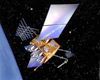
The modernized Global Positioning System Block IIR (GPS IIR-M) satellite, launched from Cape Canaveral on Oct. 17, has been declared fully operational for military and civilian navigation users around the globe, following a successful on-orbit checkout by a combined U.S. Air Force/Lockheed Martin [NYSE: LMT] team. |
|
| The content herein, unless otherwise known to be public domain, are Copyright Space.TV Corporation. AFP and UPI Wire Stories are copyright Agence France-Presse and United Press International. ESA Portal Reports are copyright European Space Agency. All NASA sourced material is public domain. Additional copyrights may apply in whole or part to other bona fide parties. Advertising does not imply endorsement, agreement or approval of any opinions, statements or information provided by Space.TV Corp on any Web page published or hosted by Space.TV Corp. Privacy Statement |