|
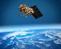
Amsterdam (AFP) Sept 24, 2007 The European polar satellite MetOp-A, launched last year, is already improving weather predictions and will soon help global environmental and security monitoring, scientists said here Monday. Scientists from Europe and the United States met in Amsterdam for a joint conference of the European meteorological satellites EUMETSAT and the American Meteorological Society, to discuss their experiences. Even though the MetOp-A satellite, which orbits the poles, only took up regular service in May this year, it is already improving the way weather is predicted because of its "unprecedented accuracy and resolution of different variables such as temperature and humidity, wind speed (and) ozone," EUMETSAT's director general Lars Prahm told a news conference. Garry Davis, of the US National Oceanic and Atmospheric Administration (NOAA), who works together with EUMETSAT, said the MetOp-A satellite provided the "biggest step forward in 30 years." The high resolution images of the satellite down to one kilometre (0.6 miles) have helped NOAA predict and track storms and wildfires better, he said. "In 2006 the US suffered through its worst wildfire season, with more than 10 million acres being burned and more than 96,000 wildfires and we are on track for another rough year," Davis said. "Working with EUMETSAT we have been able to bring out new data to help minimize the damage of these wildfires." In the coming years EUMETSAT and the European Space Agency (ESA) are predicting the polar satellite will also play a key role in the European Global Monitoring for Environment and Security initiative lead by the European Commission. Data from the satellite will be used for rapid mapping after disasters such as earthquakes and tsunamis to help organize aid. "They can answer questions of aid agencies like: are the roads passable and is there drinking water available in the area?" Volker Liebig, ESA's director of earth observation programmes, explained. The EUMETSAT data will be used to provide regular independent satellite coverage of Europe which will help to provide better maps and also to monitor the state of the ocean including the rate of the rise of sea levels, he added. Related Links Weather News at TerraDaily.com
 Geneva (AFP) Sept 20, 2007
The UN's meteorological agency on Friday called for a multibillion dollar boost for weather forecasting, warning that about 30 percent of economic wealth was directly exposed to the impact of global warming. |
|
| The content herein, unless otherwise known to be public domain, are Copyright Space.TV Corporation. AFP and UPI Wire Stories are copyright Agence France-Presse and United Press International. ESA Portal Reports are copyright European Space Agency. All NASA sourced material is public domain. Additional copyrights may apply in whole or part to other bona fide parties. Advertising does not imply endorsement, agreement or approval of any opinions, statements or information provided by Space.TV Corp on any Web page published or hosted by Space.TV Corp. Privacy Statement |