 |
Paris, France (ESA) Feb 16, 2010 The European Space Agency is about to launch the most sophisticated satellite ever to investigate the Earth's ice fields and map ice thickness over water and land: lift-off scheduled for 25 February. ESA's ice mission satellite CryoSat will be placed into orbit 700 km above Earth by a Russian Dnepr rocket to be launched from the Baikonur Cosmodrome in Kazakhstan. Lift-off is scheduled to take place at 14:57 CET (13:57 UTC) on Thursday 25 February 2010. The launcher is operated by the international space company Kosmotras. CryoSat will be the third of ESA's Earth Explorer satellites in orbit, following on from GOCE (launched in March 2009) and SMOS (launched in November 2009). It was originally due to be the first in the Earth Explorer series, but the first satellite was lost as a result of a launcher failure in October 2005. The 700 kg CryoSat spacecraft - whose name comes from the Greek kruos meaning icy cold - carries the first all-weather microwave radar altimeter. The instrument has been optimised for determining changes in the thickness of both floating sea ice, which can be up to several metres, and polar land ice sheets, which in Antarctica can be up to five kilometres. The mission will deliver data on the rate of change of the ice thickness accurate to within one centimetre. Recent record-lows in the extent of summer Arctic sea-ice cover demonstrate that significant changes are occurring in the polar regions. Ice cover has been mapped from space for many years by satellites such as Envisat. But to understand more about how climate change is affecting these sensitive regions, there is also an urgent need to determine how ice thickness is changing. Data from CryoSat will lead to a better understanding of the dynamics of ice mass, provide the scientific community with valuable information on this variable and contribute to climate change studies. On the launch day, ESA will be opening a European Press Centre at its European Space Operations Centre (ESOC) in Darmstadt, Germany, from 10:00 to 16:30, hosting a launch event from 11:30 to 16:00. A live televised transmission of the launch will provide pictures from the Baikonur Cosmodrome and from Mission Control at ESA/ESOC in Darmstadt for broadcasters (further details of TV transmission at http://television.esa.int). ESA senior management and programme specialists will be on hand to explain the mission and give interviews. Media representatives wishing to cover this event from ESA/ESOC or watch the launch live from another ESA establishment are requested to fill in the accreditation form linked on the right and fax it back to one of the numbers provided.
Share This Article With Planet Earth
Related Links ESA Cryosat Earth Observation News - Suppiliers, Technology and Application
 Fault Responsible For Haiti Quake Slices Island's Topography
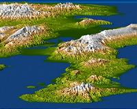
Washington DC (SPX) Jan 18, 2010 A magnitude 7.0 earthquake occurred on January 12, 2010, at Port-au-Prince, Haiti, with major impact to the region and its citizens. This perspective view of the pre-quake topography of the area clearly shows the fault that is apparently responsible for the earthquake as a prominent linear landform immediately adjacent to the city. Elevation is color coded from dark green at low elevations ... read more |
|
| The content herein, unless otherwise known to be public domain, are Copyright 1995-2010 - SpaceDaily. AFP and UPI Wire Stories are copyright Agence France-Presse and United Press International. ESA Portal Reports are copyright European Space Agency. All NASA sourced material is public domain. Additional copyrights may apply in whole or part to other bona fide parties. Advertising does not imply endorsement,agreement or approval of any opinions, statements or information provided by SpaceDaily on any Web page published or hosted by SpaceDaily. Privacy Statement |