 |
Bangalore, India (SPX) Jan 15, 2007 The Panchromatic camera (PAN) on board ISRO's latest remote sensing satellite, Cartosat-2, was switched on at 10.05 am IST today (January 12, 2007) through a series of commands issued from the Spacecraft Control Centre of ISRO Telemetry, Tracking and Command Network (ISTRAC) at Bangalore. Analysis of the first imagery received at National Remote Sensing Agency's Data Reception Station at Shadnagar, near Hyderabad, confirms excellent performance of the camera. The first imagery covered a length of about 240 km from Paonta Sahib in Shivalik region to Delhi. Another set of imagery of about 50 km length covered Radha Nagari to Sagoan in Goa before the satellite passed over the Arabian Sea. It may be recalled that the 680 kg Cartosat-2, the twelfth in the Indian Remote Sensing (IRS) satellite series, along with Space capsule Recovery Experiment (SRE-1), Indonesia's LAPAN-TUBSAT and Argentina's PEHUENSAT-1, were launched into the intended 639 km high polar orbit by PSLV-C7 from Satish Dhawan Space Centre (SDSC) SHAR, Sriharikota on January 10, 2007. Soon after its separation from the Dual Launch Adopter (DLA), the two solar arrays of Cartosat-2 were automatically deployed. The satellite is being continuously monitored and controlled from the Spacecraft Control Centre of ISTRAC at Bangalore with the help of its network of stations at Bangalore, Lucknow, Mauritius, Bearslake in Russia and Biak in Indonesia. The Ground station at Svalbard in Sweden is also supporting the mission in its initial phase. All systems in the satellite are functioning normally. Cartosat-2 is an advanced remote sensing satellite capable of providing scene-specific spot imagery. The panchromatic camera (PAN) on board the satellite can provide imagery with a spatial resolution of better than one metre and a swath of 9.6 km. The satellite can be steered up to 45 deg along as well as across the track. The data from the satellite will be used for detailed mapping and other cartographic applications at cadastral level, urban and rural infrastructure development and management, as well as applications in Land Information System (LIS) and Geographical Information System (GIS). Space capsule Recovery Experiment (SRE-1): Space capsule Recovery Experiment (SRE-1) launched by PSLV-C7 along with Cartosat-2 is functioning normally and the two microgravity experiments on board related to metallurgy and Biomimetic synthesis are expected to start soon. LAPAN-TUBSAT is also functioning satisfactorily according to the Indonesian Space agency, LAPAN. Argentina's nano satellite, PEHUENSAT-1, is expected to start sending signals soon once its battery is charged by its solar panel. Related Links Cartosat-2 Making money out of watching earth from space today Launch Pad at Space-Travel.com Earth Observation News - Suppiliers, Technology and Application
 Pasadena CA (SPX) Jan 11, 2007
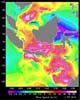
A ferry carrying more than 600 passengers sank in the Java Sea between the island of Java and Borneo just before midnight on December 29, 2006, during high winds and rough seas. On January 1, 2007, a plane carrying more than 100 people crashed on its flight over the Java Sea; high winds and turbulent weather are being investigated as possible causes. |
|
| The content herein, unless otherwise known to be public domain, are Copyright Space.TV Corporation. AFP and UPI Wire Stories are copyright Agence France-Presse and United Press International. ESA Portal Reports are copyright European Space Agency. All NASA sourced material is public domain. Additional copyrights may apply in whole or part to other bona fide parties. Advertising does not imply endorsement, agreement or approval of any opinions, statements or information provided by Space.TV Corp on any Web page published or hosted by Space.TV Corp. Privacy Statement |

