 |
Grreenbelt MD (SPX) Apr 01, 2011 Scientists tracking the annual maximum extent of Arctic sea ice said that 2011 was among the lowest ice extents measured since satellites began collecting the data in 1979. Using satellites to track Arctic ice and comparing it with data from previous years is one way that scientists track change in the Arctic system. "For the first 20 years of the satellite record, the average annual maximum was basically uniform," said Joey Comiso of NASA's Goddard Space Flight Center in Greenbelt, Md., who studies the sea ice data collected by the AMSR-E microwave sensor on NASA's Aqua satellite. "Then, we see an abrupt decline." For a closer look at polar ice, NASA scientists are in the field for the most recent leg of Operation IceBridge, an unprecedented airborne science mission to study the Earth's polar regions. On March 29, IceBridge took off for its ninth science flight since the campaign's first flight on March 16. Over the next eight weeks, researchers will continue to fly over the Arctic aboard an airborne science laboratory, tracking changes to sea ice and land ice, and even collecting some measurements not yet possible from space. Satellites and aircraft work together to document the state of the Arctic, and changes through time. For example, new research led by Nathan Kurtz, a polar scientist at Goddard, shows that large losses of sea ice in the Arctic were observed by NASA's Ice, Cloud and land Elevation Satellite (ICESat) from 2003-2008. The losses reduce the ability of the sea ice cover to insulate the atmosphere from the ocean, which increases the amount of heat transferred from the ocean to the atmosphere. That transfer, in turn, may be contributing to warming air temperatures in the Arctic, according to the research, now in press with Journal of Geophysical Research, Oceans. "With IceBridge, we will continue monitoring the loss of sea ice in the Arctic which will not only help us determine the health of the sea ice cover, but whether the impact of sea ice losses are further impacting warming in the Arctic region," Kurtz said.
Share This Article With Planet Earth
Related Links Operation IceBridge Earth Observation News - Suppiliers, Technology and Application
 RIT Researchers Help Map Tsunami And Earthquake Damage In Japan
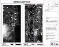
Rochester NY (SPX) Mar 31, 2011 Japan needs maps. Not just any kind-detailed informational maps georegistered with latitude and longitude and annotated with simple, self-evident details: this bridge is out, this port is damaged, this farm field is scoured; this one is verdant. Researchers at Rochester Institute of Technology are processing satellite imagery of regions in Japan affected by the 9.0 magnitude earthquake and ... read more |
|
| The content herein, unless otherwise known to be public domain, are Copyright 1995-2010 - SpaceDaily. AFP and UPI Wire Stories are copyright Agence France-Presse and United Press International. ESA Portal Reports are copyright European Space Agency. All NASA sourced material is public domain. Additional copyrights may apply in whole or part to other bona fide parties. Advertising does not imply endorsement,agreement or approval of any opinions, statements or information provided by SpaceDaily on any Web page published or hosted by SpaceDaily. Privacy Statement |