 |
Houston TX (SPX) May 05, 2009 The Houston Independent School District (HISD) has signed a contract for AT and T fleet management services, enabling the school district to wirelessly monitor its fleet of more than 1,100 school buses and official vehicles. HISD is now able to facilitate more efficient and safe management of its fleet of vehicles by using GPS technology over the AT and T wireless network. The AT and T solution enables HISD to remotely track, in real time, the location and speed of its vehicles and confirm that its buses are traveling along scheduled routes and stops. Additionally, the school district can monitor when a vehicle's ignition is turned on or off and whether or not safety lights and exit doors are working properly. "The insight delivered from this solution is invaluable - providing control, insight and accountability for managing our buses and other vehicles," said Aric Taylor, manager, Routing and Scheduling, HISD. "Remotely tracking our vehicles and drivers enhances our ability to deliver Houston ISD students to school on time and keep them safe, which is our top priority." AT and T's fleet management solution enables HISD to efficiently route its vehicles which should result in reduced fuel and maintenance costs. The school district can more efficiently complete tasks like moving school bus stops to safer, more accessible locations. Real-time communication with safety officers, whose vehicles are equipped with GPS technology, could enable HISD to complete bus stop evaluations in less than a day, a task that normally could have taken a week or more. The AT and T account team worked closely with HISD to provide a unique solution that would meet its key needs like monitoring fleet movement and responding quickly in emergencies. AT and T fleet management solutions are designed to enable customers to monitor and track their mobile assets, providing them with critical information via the AT and T wireless network, the largest high-speed wireless data network in the U.S. and the broadest international coverage of any U.S. wireless carrier. Share This Article With Planet Earth
Related Links Houston ISD GPS Applications, Technology and Suppliers
 Redlands CA (SPX) May 05, 2009
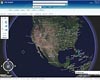
ArcGIS 9.3.1 helps you create and share modern Web maps that are relevant to your entire organization. This release of ESRI's integrated collection of geographic information system (GIS) software products focuses on improving the performance of dynamic map publishing and increasing the visibility of geographic information. |
|
| The content herein, unless otherwise known to be public domain, are Copyright 1995-2007 - SpaceDaily.AFP and UPI Wire Stories are copyright Agence France-Presse and United Press International. ESA Portal Reports are copyright European Space Agency. All NASA sourced material is public domain. Additional copyrights may apply in whole or part to other bona fide parties. Advertising does not imply endorsement,agreement or approval of any opinions, statements or information provided by SpaceDaily on any Web page published or hosted by SpaceDaily. Privacy Statement |

 del.icio.us
 Digg
Digg Reddit
 YahooMyWeb
 Google