|
|
 NASA Satellites Detect Pothole on Road to Higher Seas
Pasadena CA (JPL) Aug 24, 2011 Like mercury in a thermometer, ocean waters expand as they warm. This, along with melting glaciers and ice sheets in Greenland and Antarctica, drives sea levels higher over the long term. For the past 18 years, the U.S./French Jason-1, Jason-2 and Topex/Poseidon spacecraft have been monitoring the gradual rise of the world's ocean in response to global warming. While the rise of the global ocean has been remarkably steady for most of this time, every once in a while, sea level rise hits a speed bu ... read more |
. |

|
| Buy Advertising | Media Advertising Kit | Editorial & Other Enquiries | Privacy statement |
|
Free Newsletters - Delivered Daily Via Email - Space - War - Terra - Energy |
| .. |
 TRMM gets a look at Irene, the first hurricane of the Atlantic season The Tropical Rainfall Measuring Mission satellite has been busy measuring rainfall within Hurricane Irene, and forecasts call for between 5 and 10 inches in the southeastern and central Bahamas and ... more | .. |
 Elbit To Supply Asian Countries with Electro-Optical Payloads for Maritime Applications Elbit Systems Ltd.has been awarded contracts by several customers in Asia to supply many dozens of observation systems for maritime patrol aircraft, vessels and observation towers. The total value o ... more | .. |
 Russia grounds rockets after launch failure Russia on Tuesday grounded its workhorse Proton-M rockets after the latest in a string of launch mishaps put a prized telecommunications satellite into the wrong orbit. ... more | .. | ||
| .. |
 NASA Picks Three Proposals for Flight Demonstration NASA has selected three proposals, including one from NASA's Jet Propulsion Laboratory in Pasadena, Calif., as Technology Demonstration Missions to transform space communications, deep space navigat ... more | .. |
 Researchers Improving GPS Accuracy In The Third Dimension Researchers who are working to fix global positioning system (GPS) errors have devised software to take a more accurate measurement of altitude - particularly in mountainous areas. The softwar ... more | .. |
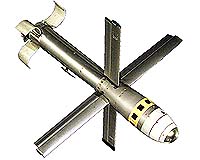 Viper Strikes With Moving Target Capability Being Added to KC-130J Arsenal Northrop Grumman has been awarded a contract for additional Viper Strikes munitions to equip the U.S. Marine Corps Harvest Hawk aircraft and bring greater utility to the Marines' KC-130J refueling a ... more | .. |
 NIST tests help ensure reliable wireless alarm beacons for first responders Wireless emergency safety equipment could save lives-if signals are transmitted reliably. But few performance standards exist. Now, tests at the National Institute of Standards and Technology (NIST) ... more |
|
Free Newsletters - Delivered Daily Via Email - Space - War - Terra - Energy |
| . | . |
|
| .. |
 e2v supply the imaging sensor focal plane to SSTL UK for the NigeriaSat-2 Earth observation satellite On 17th August 2011, e2v high performance image sensors were launched into space on NigeriaSat-2, the Earth observation satellite which has been developed for the National Space Research and Develop ... more | .. |
 Human gait could soon power portable electronics If the vision of Tom Krupenkin and J. Ashley Taylor comes to fruition, one day soon your cellphone - or just about any other portable electronic device - could be powered by simply taking a walk. ... more | .. |
 Software said to improve GPS accuracy U.S. researchers working on the accuracy of GPS location say they have set their sights on the third dimension with software to improve altitude measurements. ... more | .. |
 NASA Research Leads to First Complete Map of Antarctic Ice Flow NASA-funded researchers have created the first complete map of the speed and direction of ice flow in Antarctica. The map, which shows glaciers flowing thousands of miles from the continent's deep i ... more |
| .. |
 Airborne Sensor Helps Firefighters Battle Flames As the summer blazes on, NASA-developed infrared imaging technology will once again be used to support wildfire incident commanders in California. Beginning in September and continuing through ... more | .. |
 Watching the ice sheet of Antarctica flow A huge network of glaciers, carrying ice thousands of kilometres across Antarctica, has been discovered as a result of space agencies' efforts to focus their satellites on Earth's icy regions during ... more | .. |
 ASA Search and Rescue Software Used To Locate Capsized Boat Off Ireland SARMAP, a search and rescue mapping software solution developed by ASA (Applied Science Associates, Inc.), a Rhode Island-based science and technology solutions company, was instrumental in the effo ... more | .. |
 Google Maps taking armchair explorers to the Amazon Two women washed clothes in the dark water of the Rio Negro as a boat glided past with a camera-laden Google tricycle strapped to the roof, destined to give the world a window into the Amazon rain forest. ... more |
| Buy Advertising | Media Advertising Kit | Editorial & Other Enquiries | Privacy statement |
|
Free Newsletters - Delivered Daily Via Email - Space - War - Terra - Energy |
|
| .. |
SSTL's very high resolution satellite NigeriaSat-2 prepares for launch The latest Earth observation satellite from UK small satellite manufacturer SSTL has successfully completed pre-launch tests and has been integrated with a Dnepr launch vehicle. NigeriaSat-2, one of ... more | .. |
SSTL successfully launches two further Earth observation satellites SSTL's NigeriaSat-2 and NigeriaSat-X satellites were successfully launched Wednesday at 07:12:20 UTC onboard a Dnepr rocket from Yasny in southern Russia. The highly advanced Earth observation satel ... more | .. |
 Better method for predicting sunspots: study Scientists said Thursday they can now better predict when sunspots will erupt, offering earlier warning of magnetic disruptions that can cut power and interrupt communications on Earth. ... more | .. |
 Two SOPS calls on reliable spare for active service Demonstrating the strength of the Global Positioning System constellation of satellites, the 2nd Space Operations Squadron is set to swap out an underperforming satellite with a handy spare this wee ... more |
| .. |
 NASA Research Confirms it's a Small World, After All A NASA-led research team has confirmed what Walt Disney told us all along: Earth really is a small world, after all. Since Charles Darwin's time, scientists have speculated that the solid Earth migh ... more | .. |
S. Koreans file class action suit against Apple More than 20,000 South Korean iPhone users filed a class action lawsuit Wednesday against US technology giant Apple for alleged privacy violations over the collection of location data, a law firm said. ... more | .. |
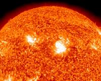 Solar Flares: What Does It Take to Be X-Class? Solar flares are giant explosions on the sun that send energy, light and high speed particles into space. These flares are often associated with solar magnetic storms known as coronal mass ejections ... more | .. |
 Unusual Fault Pattern Surfaces in Earthquake Study Like scars that remain on the skin long after a wound has healed, earthquake fault lines can be traced on Earth's surface long after their initial rupture. Typically, this line of intersection betwe ... more |
| Buy Advertising | Media Advertising Kit | Editorial & Other Enquiries | Privacy statement |
|
Free Newsletters - Delivered Daily Via Email - Space - War - Terra - Energy |
|
| .. |
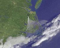 Smoke from Virginia Lateral West Fire The GOES-13 satellite captured a visible image of the thick brown smoke streaming from the Lateral West Fire burning in the Great Dismal Swamp National Wildlife Refuge (GDSBWR) in southeastern Virgi ... more | .. |
 Technology Plays Important Role to Improve the Wine Industry Great wines come from combining site selection with appropriate viticulture and winemaking skills and style. But now geographic information systems (GIS) technology plays an important role in the wi ... more | .. |
 Raytheon Wins Navy GPS Positioning, Navigation and Timing Service Contract Raytheon has been awarded a $32.2 million U.S. Navy contract for the Global Positioning System-based Positioning, Navigation and Timing Service program for Navy surface and subsurface platforms. ... more | .. |
 Raytheon Joint Standoff Weapon C-1 Completes First Free-Flight Test The U.S. Navy completed the first free-flight test of Raytheon's Joint Standoff Weapon C-1, bringing the world's only net-enabled standoff weapon with moving maritime target capability closer to ini ... more |
| .. |
 Scientists find eruption at undersea volcano after forecasting the event A team of scientists just discovered a new eruption of Axial Seamount, an undersea volcano located about 250 miles off the Oregon coast - and one of the most active and intensely studied seamounts i ... more | .. |
 China to launch civil survey satellite late this year China will put into space a high-definition civil survey satellite, the first of its kind in the country, at the end of this year, said an official of the National Administration of Surveying, Mappi ... more | .. |
 Critical Milestone Reached for 2012 Landsat Mission The Operational Land Imager (OLI), built by Ball Aerospace and Technologies Corp., Boulder, Colo., has been approved by NASA Goddard Space Flight Center for shipment to Orbital Sciences Corporation, ... more | .. |
 Sun Unleashes X6.9 Class Flare On August 9, 2011 at 3:48 a.m. EDT, the sun emitted an Earth-directed X6.9 flare, as measured by the NOAA GOES satellite. These gigantic bursts of radiation cannot pass through Earth's atmosphere to ... more |
| Previous Issues | Aug 23 | Aug 22 | Aug 19 | Aug 18 | Aug 17 |
| The contents herein, unless otherwise known to be public domain, are Copyright 1995-2011 - SpaceDaily. AFP and UPI Wire Stories are copyright Agence France-Presse and United Press International. ESA Portal Reports are copyright European Space Agency. All NASA sourced material is public domain. Additional copyrights may apply in whole or part to other bona fide parties. Advertising does not imply endorsement, agreement or approval of any opinions, statements or information provided by SpaceDaily on any web page published or hosted by SpaceDaily. Privacy statement |
|
Free Newsletters - Delivered Daily Via Email - Space - War - Terra - Energy |
| Buy Advertising | Media Advertising Kit | Editorial & Other Enquiries | Privacy statement |


