|
|
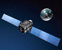
 Russia To Launch 8 Glonass Navigation Satellites In 2011-2013
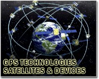
Moscow (RIA Novosti) Oct 25, 2010 Russia will put eight Glonass-M satellites into orbit in 2011-2013 to ensure the effective operation of its satellite navigation network, a Russian space industry official said. Glonass - the Global Navigation Satellite System - is the Russian equivalent of the U.S. Global Positioning System, or GPS, and is designed for both military and civilian use. The network requires 18 operational satellites for continuous navigation services covering the entire territory of Russia and at least 24 sate ... read more |
. |
|
|
Free Space, Earth, Energy And Military Newsletters - Delivered Daily |
| . | . |
 CellGuide Introduces HiMap High-Performance Urban Positioning CellGuide has announced the availability of its patent-pending HiMap technology for precision urban positioning. HiMap is now commercially available for CellGuide's ACLYS chip, ACLYS IP Core, and GP ... more | .. |
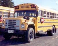 Palm Springs Unified School District Selects Networkfleet GPS Fleet Tracking Networkfleet has announced that it has been selected by the Palm Springs Unified School District (USD) of Palm Springs, California, to improve vehicle utilization, reduce fuel costs, and increase sa ... more | .. |
 DHS Conducts Nationwide ID Authentication Test For Emergency Preparedness Northrop Grumman and the U.S. Department of Homeland Security's Federal Emergency Management Agency (FEMA) recently coordinated a nationwide demonstration showing the ability to deploy a common, int ... more | .. |
 Rhinos equipped with GPS tracking Five rhinos in South Africa have been "wired" with Global Position System devices to help protect them from poachers, wildlife officials say. ... more | .. |
 Japan GPS Bird Checks Out Okay The Japan Aerospace Exploration Agency (JAXA) has been conducting the scheduled initial functional verification of the satellite bus and mission devices of the First Quasi-zenith Satellite "Michibik ... more |
|
Free Space, Earth, Energy And Military Newsletters - Delivered Daily |
| .. |
Blue Sky Network, a leading, global provider of GPS tracking and communication solutions for land, sea, and aviation assets, announced that it is now a service partner of mobile satellite service provider, Iridium Servicios de Satelites S.A. a subsidiary of Iridium Communications Inc. As an Iridium service partner in Brazil, Blue Sky Network can now provide its satellite-based GPS tracking ... more  Paris, France (ESA) Oct 19, 2010
Scientists are crediting satellite imagery with helping to predict where volcanic eruptions could strike. It is well known that earthquakes can stress Earth's crust and trigger subsequent quakes, but there has been no proof of this for volcanoes until now. In September 2005, a volcanic event in Ethiopia's Afar Desert forced magma up through rocks in a crack, known as a dyke, resulting in a ... more SymetriGEO Services, part of Astrium Services' GEO-Information division, is supporting the Geospatial and Situational Awareness Demonstration, which is part of the UK Ministry of Defence (MOD) sponsored Common Geospatial Tool Set (CGTS) research project. The objective of CGTS, which is being delivered by the Lockheed Martin (UK) led Team SPARTA, is to de-risk future geospatial capability p ... more |
.. |
 NKorea Jamming Device A New Security Threat  Google brain drives cars in quest for next auto revolution  Instant online solar energy quotes Solar Energy Solutions from ABC Solar |
.. |
|
|
Free Space, Earth, Energy And Military Newsletters - Delivered Daily |

|
. |
 KORE Telematics Introduces Location-Based Service Offering
San Francisco CA (SPX) Oct 11, 2010 KORE Telematics has announced the launch of KORE LOCATE, the industry's first location-based service offering from a mobile virtual network operator (MVNO). Providing a single interface across KORE GPRS and CDMA networks in the U.S. and Canada, KORE LOCATE complements existing GPS applications by offering a rich feature set of location-based services. With KORE LOCATE, non-GPS solutions now have the ability to track device locations. Any application service provider who is a KORE customer can make ... read more |
| The contents herein, unless otherwise known to be public domain, are Copyright 1995-2010 - SpaceDaily. AFP and UPI Wire Stories are copyright Agence France-Presse and United Press International. ESA Portal Reports are copyright European Space Agency. All NASA sourced material is public domain. Additional copyrights may apply in whole or part to other bona fide parties. Advertising does not imply endorsement, agreement or approval of any opinions, statements or information provided by SpaceDaily on any web page published or hosted by SpaceDaily. Privacy statement |
|
Free Space, Earth, Energy And Military Newsletters - Delivered Daily |
| Previous Issues | Oct 23 | Oct 22 | Oct 21 | Oct 20 | Oct 19 |