|
|
London, UK (SPX) Dec 08, 2009 Surrey Satellite Technology Limited (SSTL) has delivered eighteen SGR-10 GPS receivers to Sierra Nevada Corporation (SNC) of the USA to provide on-board orbit determination for the ORBCOMM Generation 2 (OG2) satellites. SSTL's SGR-10 is a spacecraft orbit determination sub-system designed for small and large Low Earth Orbit (LEO) satellite applications. The SGR-10 provides GPS standard ... read more |
. |
|
|
Free Space, Earth, Energy And Military Newsletters - Delivered Daily |
| .. |
 Orlando, Fla. (UPI) Nov 30, 2009
 The world's first device capable of tracking multiple people without attached sensors is here, and scientists see in the invention opportunities for more efficient military training and warfare readiness. Orlando-based Organic Motion computer vision company unveiled the tracking platform at the Interservice Industry Training, Simulation and Education Conference, the world's largest of ... more  Paris (UPI) Nov 30, 2009
 France has taken delivery of laser-guided precision bombs and intends to use them in Afghanistan. Raytheon's Paveway II (P2) laser-guided smart bombs already equip the French air force's Mirage 200D, which supports U.S. and other NATO forces in Afghanistan. "We have indeed received what we ordered," an unnamed French air force official told Defense News. "We hope to use them in ... more  Boulder CO (SPX) Nov 25, 2009
A research team led by the University of Colorado at Boulder has found a clever way to use traditional GPS satellite signals to measure snow depth as well as soil and vegetation moisture, a technique expected to benefit meteorologists, water resource managers, climate modelers and farmers. The researchers have developed a technique that uses interference patterns created when GPS signals ... more |
.. |
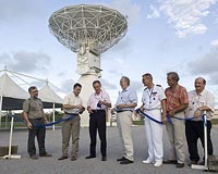 Inauguration Of Site Of Galileo Station At Kourou  NGC TRo Supply AHRS For NEURON European UCAV Demo Project Seeing Stars, Proba-2 Platform Passes Its First Health Check |
.. |
|
|
Free Space, Earth, Energy And Military Newsletters - Delivered Daily |
| .. |
 Lokoja, Nigeria (AFP) Nov 8, 2009
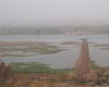
After decades of delay and wrangling by resisting riverine communities, Nigeria has launched a multi-million-dollar dredging exercise to boost navigation and commerce on the Niger River. Plans are to deepen the river channel and stabilise its banks along a stretch of 572 kilometers (376 miles) as to allow passage of large vessels and open up inland ports. "The goal is to activate the nav ... more  Fort Bragg NC (AFNS) Nov 04, 2009
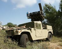
Soldiers with 3rd Battalion, 27th Field Artillery, drove their High Mobility Artillery Rocket System (HIMARS) out the rear of an Air Force C-17 Globemaster III at Pope Air Force Base, N.C., Oct. 22, with a new advancement that will get them into the fight faster. The 'Hot Panel' program allows the HIMARS to link into an aircraft's GPS and track itself in the air, anywhere in the world. The ... more  Washington DC (SPX) Nov 04, 2009
Launched from Vandenberg Air Force Base, Calif., aboard an United Launch Alliance Atlas V launch vehicle, Oct. 18, 2009, the Special Sensor Ultraviolet Limb Imager (SSULI) developed by NRL's Space Science Division and Spacecraft Engineering Department offers a first of its kind technique for remote sensing of the ionosphere and thermosphere from space. Flying on-orbit the U.S. Air Force ... more |
.. |
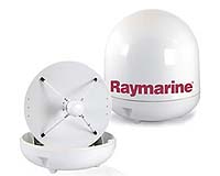 Raymarine's New 33STV Brings Superior Satellite TV To Smaller Vessels  AFSPC Reaches Out To Space Camp Youth 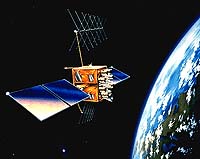 LockMart GPS Satellite Achieves 10 Years Of On-Orbit Operations |
.. |
|
|
Free Space, Earth, Energy And Military Newsletters - Delivered Daily |
| The contents herein, unless otherwise known to be public domain, are Copyright 1995-2010 - SpaceDaily. AFP and UPI Wire Stories are copyright Agence France-Presse and United Press International. ESA Portal Reports are copyright European Space Agency. All NASA sourced material is public domain. Additional copyrights may apply in whole or part to other bona fide parties. Advertising does not imply endorsement, agreement or approval of any opinions, statements or information provided by SpaceDaily on any web page published or hosted by SpaceDaily. Privacy statement |
| Previous Issues | Dec 07 | Dec 06 | Dec 03 | Dec 02 | Dec 01 |