|
|
Houstin TX (SPX) Jul 31, 2009  Twin satellite deployments and a check of the systems that will control Endeavour's return home to the Kennedy Space Center, Florida, are on tap today as the shuttle leads the International Space Station in orbit. The crew was awakened at 1:03 a.m. CDT to the sounds of "I Got You Babe," performed by Sonny and Cher. The song was a special request for Koichi Wakata, the first Japan Aerospace ... read more
 Columbia MD (SPX) Jul 30, 2009
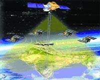
Integral Systems, Inc has submitted a proposal to deliver an integrated, advanced command and control solution for the Global Positioning System (GPS) Next Generation Advanced Control Segment (OCX) program. Integral Systems is a member of the Northrop Grumman team competing for the open-architecture, next-generation control segment contract. GPS OCX will provide command and control ... more
|
| |||||||||||||||
| Previous Issues | Jul 30 | Jul 29 | Jul 28 | Jul 27 | Jul 26 |
| . |
 Overland Park KS (SPX) Jul 30, 2009
Sprint and ValleyCrest Landscape Companies have announced an agreement for Sprint to add GPS services to ValleyCrest's communications toolkit at select branch locations. The location-based services (LBS) will help ValleyCrest better track employee job location and company assets for these field branches. The tool also helps the landscape and lawn maintenance giant handle payroll and route ... more Businesses have an exciting new tool to gain insight into their business operations with ESRI MapIt. A new software product from ESRI, the market leader in geographic information systems (GIS), MapIt combines software with services to enable businesses to create maps displaying their enterprise data. MapIt software transforms the static spreadsheet and tabular data that managers typically ... more  Yarmouth ME (SPX) Jul 30, 2009
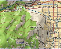
DeLorme has announced its release of the 2009 edition of USA Topographic Map Data for use with the XMap GIS software suite. This unique dataset offers users of DeLorme's three-tiered XMap GIS suite a highly detailed and customizable base map with coverage for the U.S., Canada, and Mexico on a single DVD. This latest release of the USA Topographic Map Data 2009 includes a significant number ... more |
. |
|
|
. |
 Washington (UPI) Jul 23, 2009
 The party's getting rough. Elementary manners, let alone civility, are anachronisms on the evening cable talk programs where Larry King is the courteous softball exception. Gossip is served up as news, whammy as commentary, fiction as fact, biases as straight news reporting. A new journalism of assertion and vilification has displaced the old journalism of verification. Inflammatory verbal ... more  Baikonur, Kazakhstan (SPX) Jul 24, 2009
Thursday 23rd July 2009- SSTL's UK-DMC2 satellite has successfully completed pre-launch tests and is integrated with a Dnepr launch vehicle at the Baikonur Cosmodrome in readiness for launch on Wednesday, 29th July 2009 at 18:46 UTC, 19:46 BST. The new satellite will be operated by subsidiary company DMCii to provide an enhanced imaging capability and operational service to the Disaster ... more  Madrid, Spain (SPX) Jul 23, 2009
GMV is leading a team of 12 European-based companies to develop a road sector project called GINA for the European GNSS Supervisory Authority (GSA). GINA involves utilizing EGNOS, the European Geostationary Navigation Overlay Service and GALILEO, the European satellite-navigation program, to ensure the highest degree of accuracy of vehicle positioning and position integrity to prevent driv ... more |
. |
| Previous Issues | Jul 30 | Jul 29 | Jul 28 | Jul 27 | Jul 26 |
| The contents herein, unless otherwise known to be public domain, are Copyright 1995-2009 - SpaceDaily. AFP and UPI Wire Stories are copyright Agence France-Presse and United Press International. ESA Portal Reports are copyright European Space Agency. All NASA sourced material is public domain. Additional copyrights may apply in whole or part to other bona fide parties. Advertising does not imply endorsement, agreement or approval of any opinions, statements or information provided by SpaceDaily on any web page published or hosted by SpaceDaily. Privacy statement |