|
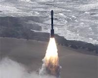
Air Force Space Command Public Affairs Office Peterson AFB CO (SPX) Jul 10, 2008 What started as the simple idea of a clock in space with an absolutely known location to aid the U.S. military in navigation has given birth to a technological explosion with reverberations throughout the world. Not only are Americans empowered by this technology, scientists from Asia, aviators and airport managers in Africa and farmers in Europe are becoming safer and more productive because of it. What is being done with this "very accurate clock?" On the military side it provides precision strike capabilities, the locations of friendly forces and vehicles, timing and much, much more. The military was the earliest and most noted beneficiary of GPS technology, and probably is the user that comes to mind first for most people. However, the civilian world has benefited tremendously from GPS, too, and much less is known about that aspect of the story. "GPS is not just an American capability," General Hyten said. "GPS has become the gold standard for the world. Our job is to maintain that gold standard. And we are going to do it because it is critical to so many capabilities in the military and civilian worlds." Some ways GPS touches us all include: Timing: According to the GPS website, precise time is crucial to a variety of economic activities around the world. Communication systems, electrical power grids, and financial networks all rely on precision timing for synchronization and operational efficiency. The free availability of GPS time has enabled cost savings for companies that depend on precise time. They can link to the GPS system at no cost and get the most accurate time available. Roads, Highways and Railroads: One of the most obvious uses of GPS is to track vehicles as they travel through the air, on the ground and over water. Building on that foundation, modern ground transportation industries and governmental elements use GPS to operate business more effectively and move huge numbers of people every day. According to www.gps.gov, the U.S. government website on GPS, "using GPS technology to help track and forecast the movement of freight has made a logistical revolution." "The promise of GPS Technology for increasing safety and security, reducing congestion, and improving efficiency are limitless. Quite simply, GPS has become the enabling technology for transportation," said Jeffrey N. Shane, Under Secretary for Policy, U.S. Department of Transportation. Aviation: GPS provides new and more efficient routes that save carriers money and get passengers to their destinations faster. The U.S. government GPS webpage says that, "the trend toward an Area Navigation concept means a greater role for GPS. Area Navigation allows aircraft to fly user-preferred routes from waypoint to waypoint, where waypoints do not depend on ground infrastructure." Marine: GPS provides the fastest and most accurate method for mariners to navigate, measure speed, and determine location. This enables increased levels of safety and efficiency for mariners worldwide. Marine users need very specific information relating to the sea bed, navigable channels, and other pieces of maritime data that enables them to navigate safely. Of course, the sea itself is reasonably featureless, but beneath the surface, quite some detail is needed to be sure that the vessel will not become grounded. Space: Space exploration has any number of inherent levels of difficulty. NASA is looking at GPS as a model for position-navigation and timing systems that would support a permanent astronaut base on the moon, as well as for when they send astronauts to Mars. These could support geographical and scientific explorations of the moon and Mars. The potential is that, using GPS as the model, several lunar and planetary systems could be built and deployed as the human exploration of space moves outward into the universe. Agriculture: Precision agriculture is now changing the way farmers and agribusiness view the land from which they reap their profits. Precision agriculture is an information-based agricultural system designed to improve the agricultural process by precisely managing each step of the planting, fertilizing, growing and harvesting processes to ensure maximum agricultural production and continued sustainability of the natural resources. The end result is that farmers and ranchers can now manage their land by the square yard instead of the square mile. Environment: Opportunities for GPS technologies to serve the environment are constantly being exploited and developed. Technology writer Elwyn McLachlan with Trimble Navigation Ltd. wrote "Forest and natural resource applications can achieve significant gains through employing GPS data collection technologies. "Where previously data was collected using pen and paper, estimating locations on paper maps, or using a compass and chain to determine positions, GPS systems have allowed data collection to be streamlined, and result in more accurate and consistent information," McLachlan added. "The use of GPS to provide location information is now commonplace, and cases are coming to court where proof of ownership or liability is tied to GPS-derived data. Public Safety and Disaster Relief: In a Sept. 21, 2006 speech to a U.S. Chamber of Commerce luncheon in Washington, D.C., Edward Morris, director of the Office of Space Commercialization, National Oceanic and Atmospheric Administration said, "GPS, proved to be indispensable during the relief and recovery operations following hurricanes of the 2005 season. Unaffected by weather conditions, GPS continued to provide accurate location information to rescue workers after entire neighborhoods were left unrecognizable. GPS allowed relief vessels to safely navigate into areas where ground-based navigation aids were no longer functioning." Recreation: Geocaching is an interesting pastime. It requires a GPS receiver and some time. Played around the world, players hide a "cache" - a waterproof container with a log book and trinkets inside - and other players try to find it using GPS coordinates and clues posted on one of several websites (GeoCaching.com). Hiking, camping, mountain biking and even wildlife observation can be enhanced by GPS technology either by using a handheld unit to identify locations, or routes of travel. Photographing environmental scenes or wildlife can also utilize this technology as well, since a GPS-enabled camera can print out a date/time stamp along with coordinates of where the photo was taken. The U. S. Coast Guard Navigation Center coordinates and manages the Civil GPS Service Interface Committee (CGSIC) as part of the Department of Transportation's program to respond to the needs of civil GPS users, and to integrate GPS into civil sector applications. CGSIC comprises members from U.S. and international private, government, and industry user groups. "GPS is one of the greatest success stories in the history of the space command and it is one of the greatest success stories in the history of the Air Force," said General Hyten. "The decision last year to not put selective availability on the future block of GPS satellites means that GPS will always be a free, open service, and this should put confidence in the rest of the world. GPS is going to continue to grow - and you see it everywhere, from bass boats to your car, to golf carts, to bombs, everything is utilizing our GPS system," he concluded. Related Links the missing link GPS Applications, Technology and Suppliers
 Beijing, China (SPX) Jul 10, 2008
Motorola has launched in China the latest members of its popular PDA series - MING A1600, MING A1800 and MOTO A810. |
|
| The content herein, unless otherwise known to be public domain, are Copyright Space.TV Corporation. AFP and UPI Wire Stories are copyright Agence France-Presse and United Press International. ESA Portal Reports are copyright European Space Agency. All NASA sourced material is public domain. Additional copyrights may apply in whole or part to other bona fide parties. Advertising does not imply endorsement, agreement or approval of any opinions, statements or information provided by Space.TV Corp on any Web page published or hosted by Space.TV Corp. Privacy Statement |