|
 China Launches New Mapping Satellite
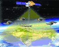
Jiuquan, Gansu (XNA) Aug 26, 2010 China successfully launched a mapping satellite, "Mapping Satellite - I," from the northwestern Jiuquan Satellite Launch Center at 3:10 p.m. (Beijing time) Tuesday. The satellite, which was launched on a Long March 2-D carrier rocket, had entered into the preset orbit, according to the center. The satellite, developed by a company under the China Aerospace Science and Technology Corporation (CASC), would be mainly used to conduct scientific experiments, carry out surveys on land resources, a ... read more |
. |
|
|
Free Space, Earth, Energy And Military Newsletters - Delivered Daily |
| . | . |
| .. |
 Jacksonville FL (SPX) Aug 10, 2010
Sea Star Line announced that it has entered into a strategic alliance with Mark-It Services in order to equip their refrigerated systems (Reefers) with both Global Positioning and Radio Frequency Identifications Systems creating the Sea Star Line Refrigerated Cargo Guardian Service. In an industry first, Sea Star Line introduces the Sea Star Line refrigerated cargo Guardian Service. The ne ... more GeoEye has announced it won a $3.8 billion contract award from the National Geospatial-Intelligence Agency (NGA) for increased commercial satellite-imaging capacity. This competitively awarded contract supports the EnhancedView program by providing products and services that will help meet the increasing geospatial intelligence needs of the intelligence community and Department of Defense. ... more  Newtown PA (SPX) Aug 10, 2010
The fifth Global Positioning System Block IIR (GPS IIR-5) satellite, designed and built by Lockheed Martin to provide critical navigation capabilities for military and civilian users worldwide, has reached 10 years of successful on-orbit operations. The satellite was launched on July 16, 2000, and is one of 30 GPS spacecraft currently on-orbit delivering vital situational awareness and pre ... more |
.. |
 Runzheimer International Reduces Corporate Mileage Expenses  US appeals court nixes GPS tracking without warrant  Instant online solar energy quotes Solar Energy Solutions from ABC Solar |
.. |
|
|
Free Space, Earth, Energy And Military Newsletters - Delivered Daily |

|
. |
 NASA Images Show Continuing Mexico Quake Deformation
Pasadena CA (JPL) Aug 06, 2010 New NASA airborne radar images of Southern California near the U.S.-Mexico border show Earth's surface is continuing to deform following the April 4 magnitude, 7.2 temblor and its many aftershocks that have rocked Mexico's state of Baja California and parts of the American Southwest. The data, from NASA's airborne Uninhabited Aerial Vehicle Synthetic Aperture Radar (UAVSAR), reveal that some faults in the area west of Calexico, Calif., have continued to move at Earth's surface, most likely in the ... read more |
| The contents herein, unless otherwise known to be public domain, are Copyright 1995-2010 - SpaceDaily. AFP and UPI Wire Stories are copyright Agence France-Presse and United Press International. ESA Portal Reports are copyright European Space Agency. All NASA sourced material is public domain. Additional copyrights may apply in whole or part to other bona fide parties. Advertising does not imply endorsement, agreement or approval of any opinions, statements or information provided by SpaceDaily on any web page published or hosted by SpaceDaily. Privacy statement |
| Previous Issues | Aug 25 | Aug 24 | Aug 23 | Aug 20 | Aug 19 |