|
|
San Francisco (AFP) Aug 18, 2009 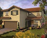 SmartZip has built a free online tool for prospective home buyers and real estate investors eager to mine gems from the rubble of the US foreclosure avalanche. Engineers at newly-launched SmartZip.com crafted software to rate the appreciation potential of homes by analyzing job trends, population growth, crime statistics, school districts, real estate price patterns and more. The result ... read more
 Cape Canaveral FL (SPX) Aug 18, 2009
The 48th successful and final Air Force Delta II Global Positioning System satellite launch occurred today, ending one of the most successful space launch programs in American history. A United Launch Alliance Delta II rocket launched GPS IIR-21(M) into orbit from Space Launch Complex-17A at 6:35 a.m., EDT today. The first Air Force Delta II GPS launch occurred Feb. 14, 1989 and today's ... more
|
| |||||||||||||||
| Previous Issues | Aug 19 | Aug 18 | Aug 17 | Aug 16 | Aug 13 |
| . |
 Washington (UPI) Aug 17, 2009
 Amid continuing tension over political upheaval in Iran, the U.S. Defense Department says it wants to accelerate production of a 30,000-pound "ultra-large bunker-buster" bomb designed to destroy deeply buried installations. The Pentagon has requested Congress to provide the necessary funding to ensure that the Massive Ordnance Penetrator, a next-generation bomb known as MOP and built by ... more  Madison WI (SPX) Aug 18, 2009
Grassed waterways are placed in agricultural fields where runoff water tends to concentrate because they can substantially reduce soil erosion. Mapping techniques that help identify where erosion channels will likely form could help farmers and conservation professionals do a better job of designing and locating grassed waterways in agricultural fields. Tom Mueller, associate professor in ... more  Concord MA (SPX) Aug 18, 2009
Everyday Solutions has announced that Charlotte County Public Schools (CCPS) based in Port Charlotte, FL has standardized on GPS-driven applications from Everyday Solutions. "We expect to see many benefits from using Everyday Solutions' GPS-driven applications to manage our school bus fleet." says Richard Duckworth, Transportation Director at CCPS. "Accurate GPS information will ... more |
. |
|
|
. |
 New Delhi, India (SPX) Aug 10, 2009
The Union Cabinet has approved undertaking design and development of GSAT-10 spacecraft at a cost of Rs.735.00 crores with a Foreign Exchange component of Rs.634.00 crores. GSAT-10 satellite with 12 high power Ku-band transponders, 12 C-band and 12 Extended C band India coverage transponders and a navigation payload, will replace the ageing INSAT-2E and INSAT-3B satellites, create addition ... more  Redlands CA (SPX) Aug 10, 2009
ESRI has released an updated version of ArcGIS Business Analyst desktop software, which includes new features designed to optimize geographic analysis for businesses. ArcGIS Business Analyst desktop enables location-based analysis with updated demographic and lifestyle segmentation data, allowing analysts to place customer and company data into a geographic context. In a slow economy ... more  Hanscom AFB MA (AFNS) Aug 07, 2009
Last month's award of three $30-million concept development contracts for the Space Fence program will yield an outcropping of risk reduction activities designed to improve the overall space surveillance network. "This is truly a classic multi-contractor, prototyping risk-reduction effort, and a return on the investment of the program to gather data to improve the follow-on phases," said L ... more |
. |
| Previous Issues | Aug 19 | Aug 18 | Aug 17 | Aug 16 | Aug 13 |
| The contents herein, unless otherwise known to be public domain, are Copyright 1995-2009 - SpaceDaily. AFP and UPI Wire Stories are copyright Agence France-Presse and United Press International. ESA Portal Reports are copyright European Space Agency. All NASA sourced material is public domain. Additional copyrights may apply in whole or part to other bona fide parties. Advertising does not imply endorsement, agreement or approval of any opinions, statements or information provided by SpaceDaily on any web page published or hosted by SpaceDaily. Privacy statement |